Riding the Pamir Highway by Motorcycle:
The Road That Changes Everything
From Dushanbe to Osh, 1,500 km across the roof of the world, a viral lost license plate, and the road trip of a lifetime.
The Pamir Highway: Why This Road Is in a Category of Its Own
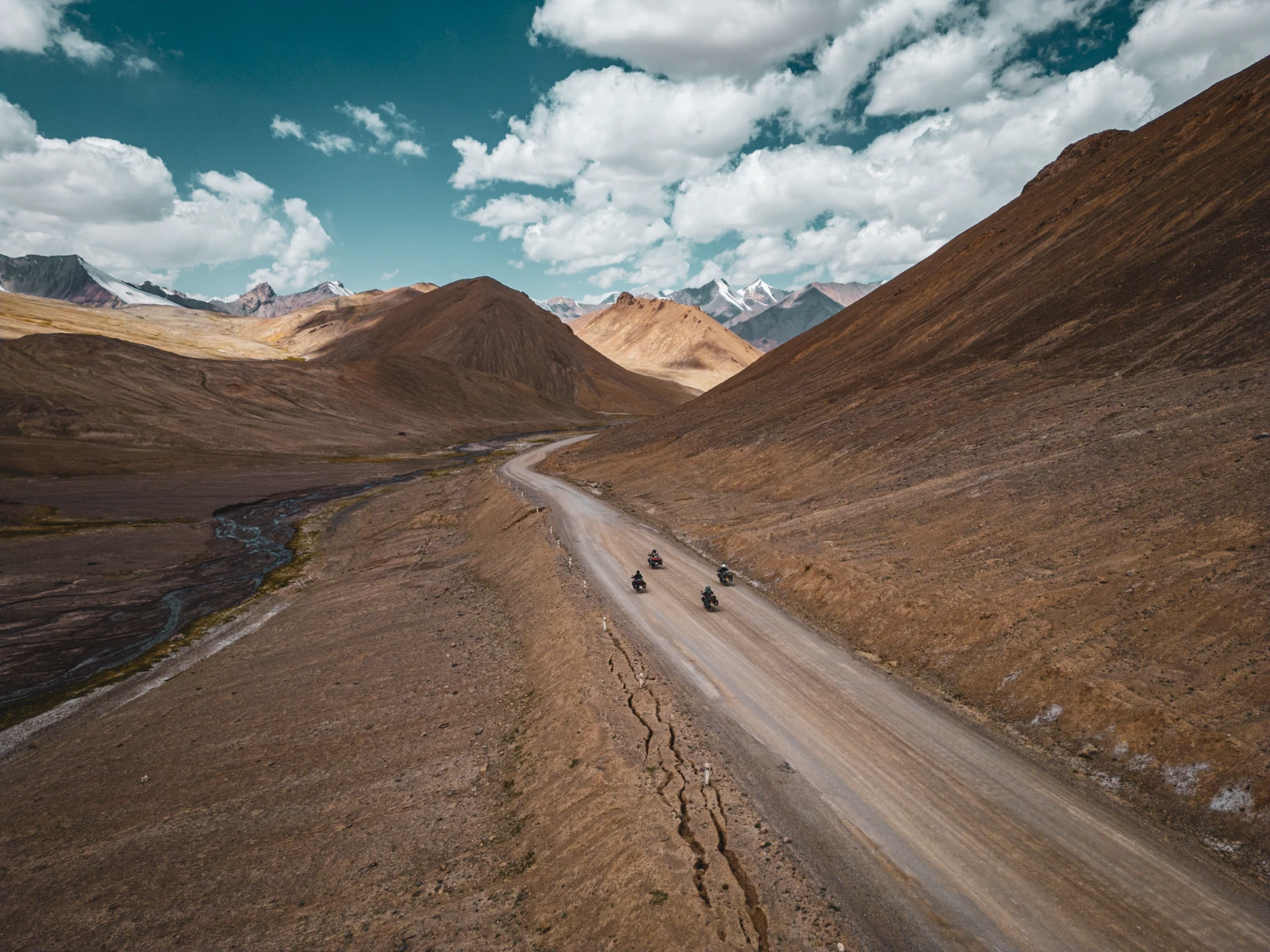
There are roads that take you somewhere. And then there is the Pamir Highway, officially the M41, a road that does something entirely different: it takes you into yourself, whether you want to or not. Stretching roughly 1,252 kilometres from Dushanbe, Tajikistan, to Osh, Kyrgyzstan, across the Pamir plateau, the « Roof of the World », it is widely considered one of the greatest overland routes on the planet, second in altitude only to the Karakoram Highway.
Moreover, the M41 was built by the Soviet Union in the 1930s, following ancient Silk Road trade routes that merchants and conquerors had navigated for millennia. Alexander the Great passed through here. Marco Polo described these mountains. Today, the road cuts through the Gorno-Badakhshan Autonomous Region (GBAO) of Tajikistan, a vast, sparsely populated territory where the average altitude sits above 3,500 metres, yak herds outnumber cars, and the nearest mechanic might be 200 kilometres away.
For motorcyclists and overlanders, specifically, the Pamir Highway is a rite of passage. Not because it’s the most technical road in the world, it’s not. But because of what it combines: stunning high-altitude desert landscapes, mud tracks and flooded river crossings, the ghost of the Afghan border running alongside you for days, the warmth of Pamiri families who will feed you without hesitation, the silence of steppes so vast you feel genuinely small, and the knowledge that you’re far, far from your comfort zone.
In August 2024, we rode it, three years into our NeverEnding Journey on our BMW F800 GS, Falkor. Two-up. With four friends. And we lost our license plate somewhere in the Wakhan Valley. What happened next got 6.1 million views on Instagram. But we’re getting ahead of ourselves.
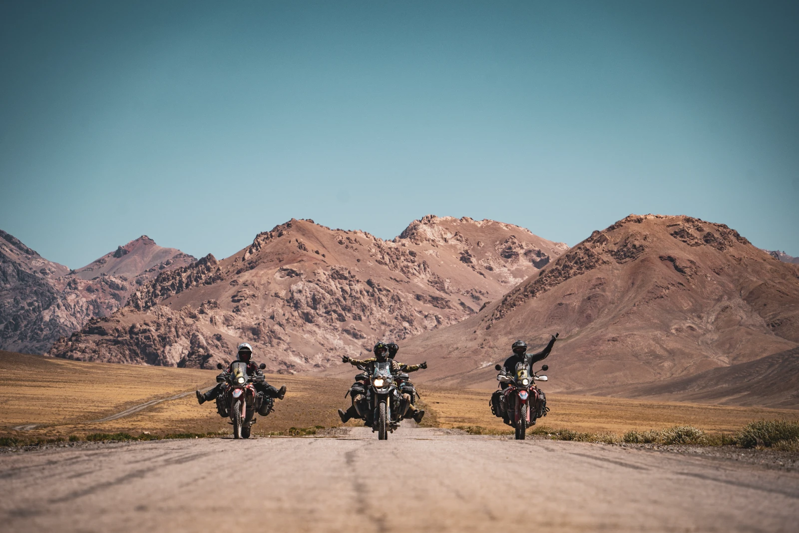
Five Riders, One Mythical Road
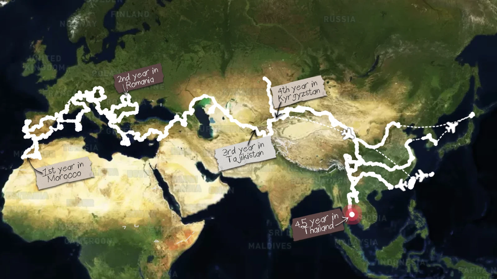
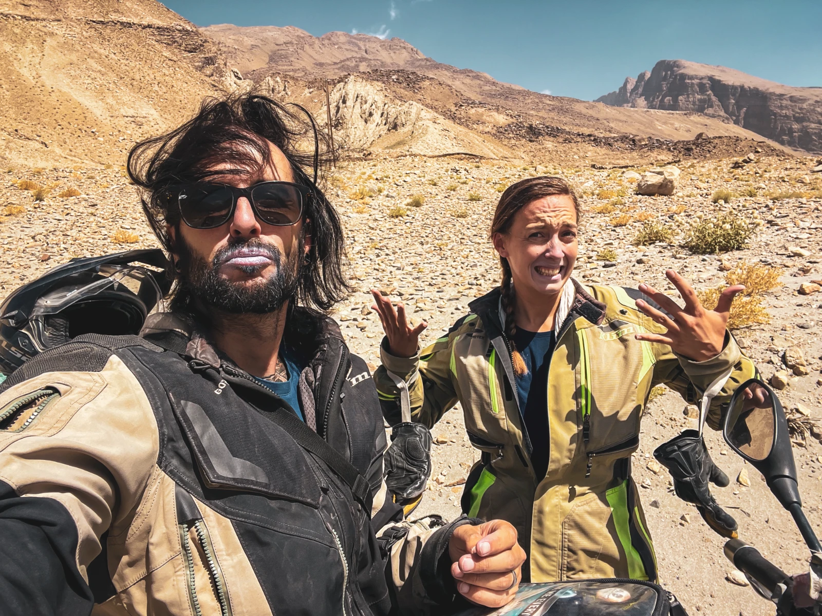
Before we dive into the road itself, a quick introduction, because this story is as much about the people as it is about the kilometres. We are Vins & Natha, a Swiss couple who left our apartment in Switzerland on August 1, 2021, with zero return ticket and a wine bottle that spun on a world map to choose our direction. Three years later, that same adventure brought us to Central Asia, two-up on our trusted BMW F800 GS, Falkor, named after the Luck Dragon from The NeverEnding Story. Because you have to keep dreaming, or the Nothing wins.
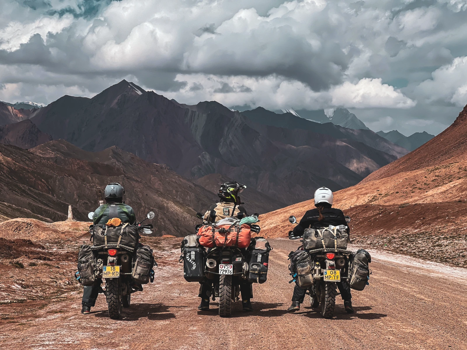
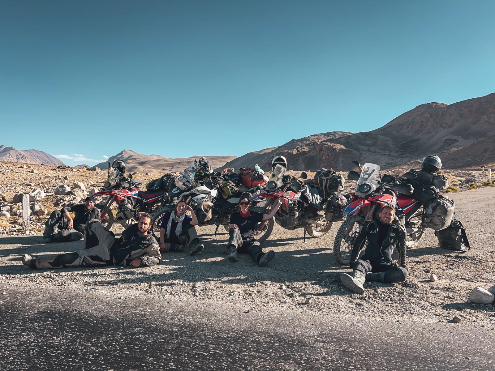
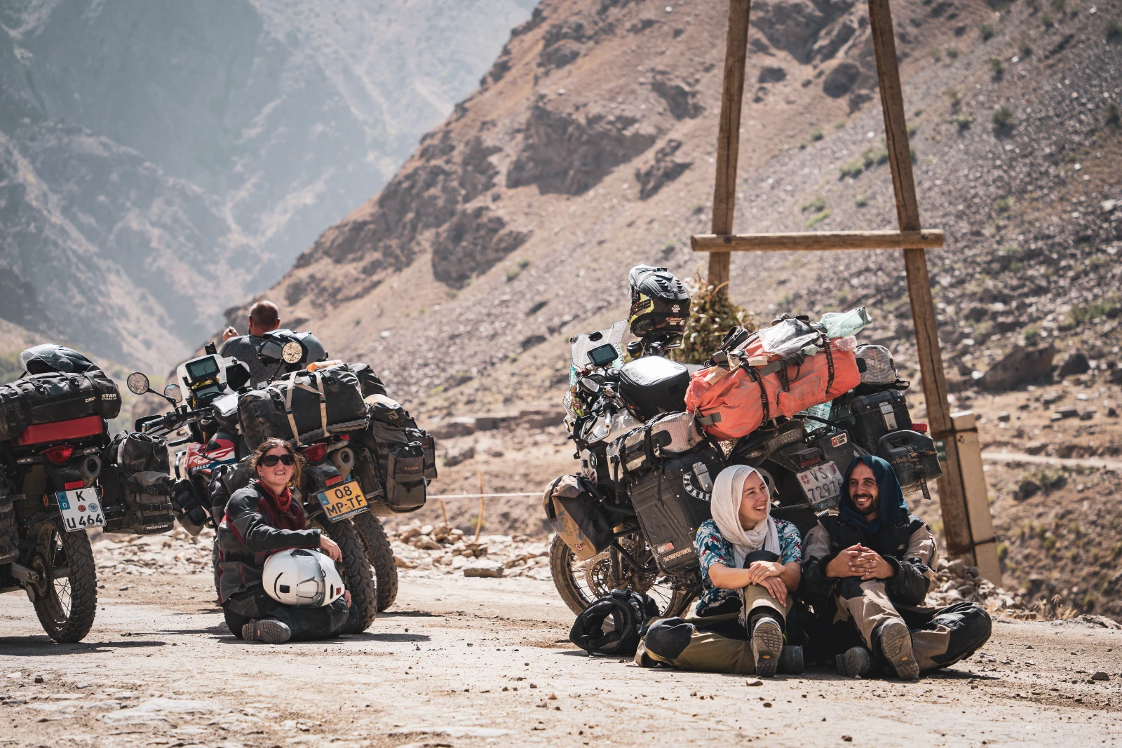
We didn’t ride the Pamir alone. By some beautiful twist of fate, the kind that only happens when you’ve been on the road long enough, we found ourselves crossing it with four remarkable people who’ve since become some of our closest friends.
Vins & Natha
Swiss nomads, 3 years on the road. Two-up on a BMW F800 GS 2014 named Falkor. Started this journey with a wine bottle spin. Paired with Insta360 as official partners for the perfect documentation.
Sander & Iris
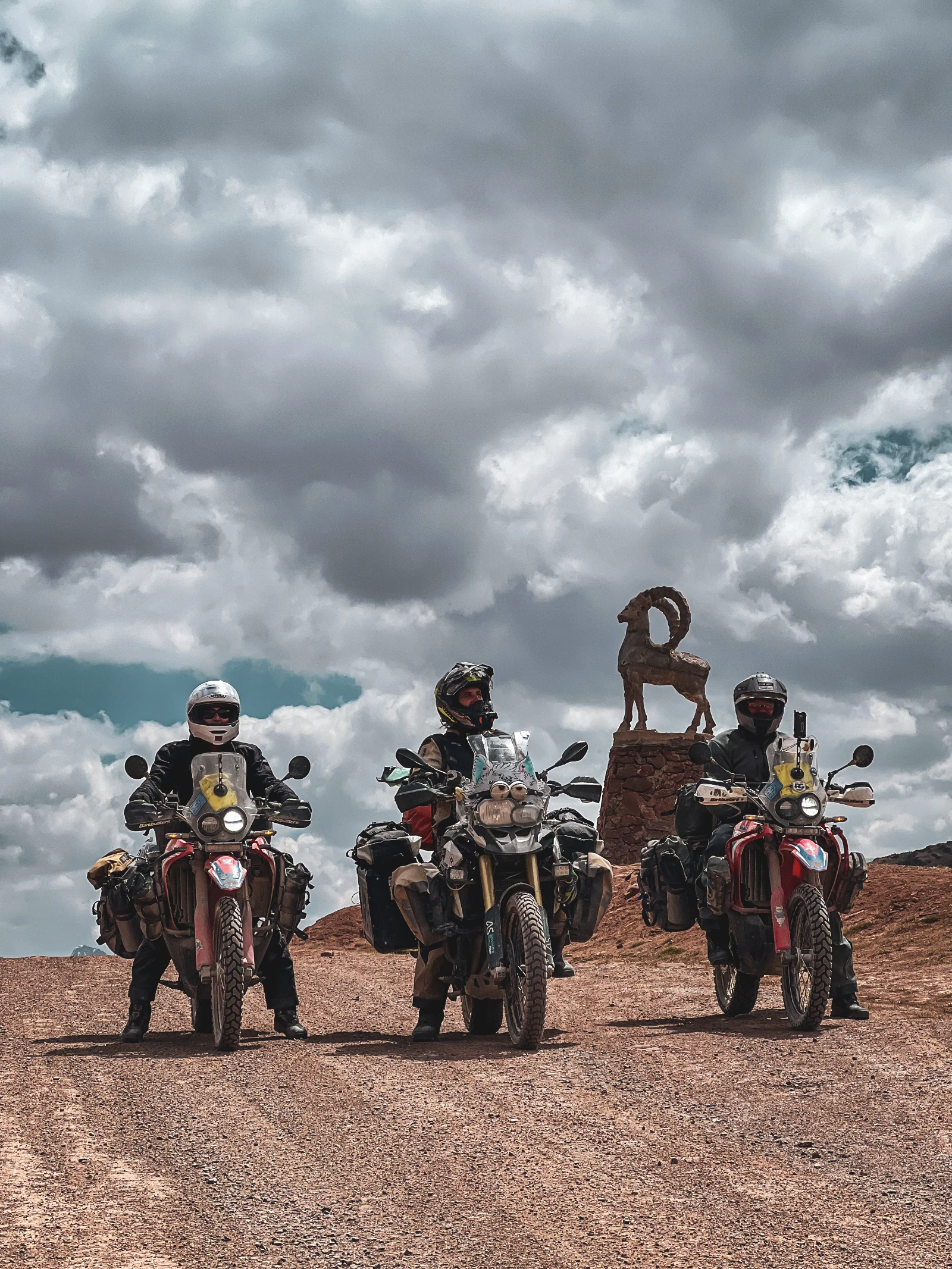
A Dutch couple we first met at MotoCamp Bulgaria. We’ve since crossed Crete, Armenia, Georgia, Russia, Kazakhstan, Uzbekistan and Tajikistan together. Riding CRF 300 Rally motorcycles.
Seb 🇩🇪
A German solo rider we met by chance at the Kazakhstan-Uzbekistan border crossing in Beyneu / Kungrad. Also on a CRF 300 Rally. Six weeks of riding together turned a stranger into someone we’ll never forget.
Khorog → Wakhan Valley → Murghab →
Ak Baital Pass (4,655m) → Karakol → Osh
Samarkand & the Seven Lakes: The Pamir Begins to Tease
Our Pamir adventure technically started a few days before we even reached Tajikistan, in Samarkand, Uzbekistan, a city of impossible mosques and golden madrasas straight out of A Thousand and One Nights. We were already a group of five by then, and Uzbekistan was doing its best to keep us on our toes: Seb’s camera stolen at a restaurant, a police investigation that turned into a comedy of WhatsApp messages and mysterious « found objects, » Natha riding with fever, and everyone’s stomach playing Russian roulette with the local food. Standard pre-Pamir warm-up.
The Tajik border crossing was blessedly smooth, but the town of Panjakent after it managed to swallow a solid three hours of our afternoon: an ATM that ate Seb’s bank card, a SIM card process involving two separate computer crashes, and a Western Union detour that no one planned for. By the time we actually got onto the piste toward the Seven Lakes (Haft Kul), we were running late, arriving at the third lake at 7:30 PM with barely enough light to pitch tents. Not ideal.
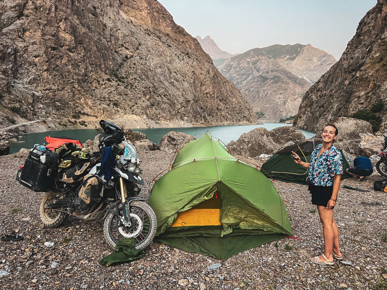
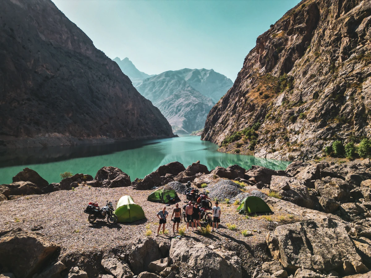
What we found there, though, was worth every minute of delay. We set up camp on a rocky islet between lakes three and four, ate pasta by lantern light, and dipped into water so cold it felt like a reset button for the soul. Just us, the mountains, the dark water, and the silence. One scooter passed on the piste. Nothing else. This was the first taste of what the next two weeks would serve us in abundance: beautiful, brutal, unforgettable remoteness.
The Death Tunnel: A Metaphor We Couldn’t Have Planned
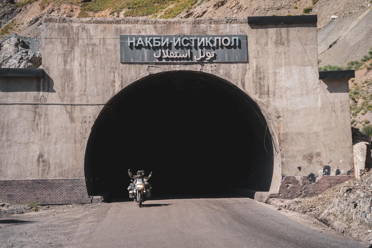
July 27, 2024. Three years since we walked out of our Swiss apartment and pointed our life in the direction of a spinning wine bottle. We celebrated by riding through the Ansob Tunnel, also known as the « Death Tunnel ».
Dramatic? Absolutely. But hear us out.
The Ansob tunnel is 5.3 kilometres of barely-lit Soviet infrastructure bored through the mountains north of Dushanbe. The road inside is broken. The ventilation is poor. Other vehicles overtake at speed in the near-darkness. People have died here. The alternative is a mountain pass that adds hours to your day, which is why Sander and Iris took it, while we and Seb, in a moment of either courage or madness (we still debate which), chose to go through.
We put our hazard lights on. We rode into the black. It was cold. It was surreal. For seven long minutes, with water running across the road and headlights appearing suddenly in the darkness ahead, we moved slowly and deliberately toward a tiny circle of light at the far end. And when we came out the other side, blinking in the afternoon sun, the mountains spread out around us in breathtaking beauty, and we both burst into tears.
Dushanbe: Permits, Cake, Samsung & the Last Hot Shower for a While
We arrived in Dushanbe in a state of emotional overflow, three years on the road, just emerged from a tunnel that people told us not to take, surrounded by mountains that took our breath away. The Tajik capital greeted us with one thing above all else: heat. Delirious, suffocating, 45°C-at-9pm heat. The city is a strange mix of Soviet-era grandeur, half-finished ring roads, and leafy boulevards where the air barely moves.
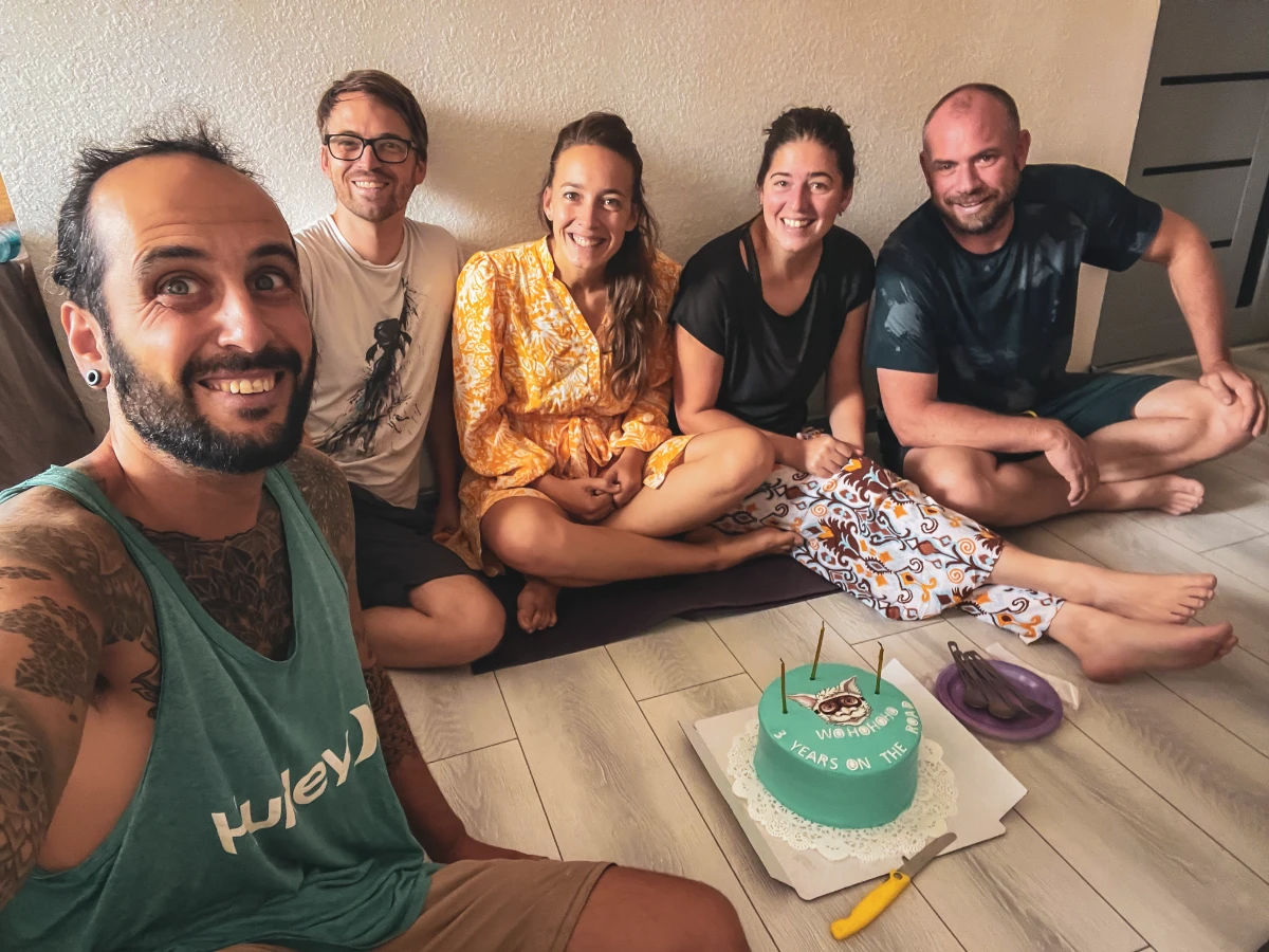
Our base was the Green House Hostel, the unofficial HQ of every overlander passing through Dushanbe. Cyclists, motorcyclists, van-lifers, everyone finds their way here eventually. Within hours of arriving, we had found Sander and Iris (who had taken the mountain pass instead of the death tunnel), reconnected with other travellers we’d crossed paths with weeks before, and been given an absolutely beautiful surprise: a Falkor-shaped birthday cake, made by Seb, Sander and Iris to celebrate our three years. A Luck Dragon in chocolate icing, on the roof of the world. We cried again. It had been that kind of day.
Fortunately, Dushanbe gave us two precious days of logistics before the real adventure began. The most important item on the list: the GBAO permit (Gorno-Badakhshan Autonomous Oblast permit), which is mandatory for anyone riding the Pamir Highway. It’s obtained at the Ministry of Foreign Affairs in Dushanbe in a single day, a surprisingly smooth process, though you’ll also need to register your presence as a tourist within 72 hours of arrival (your guesthouse usually handles this). We made 10–12 copies of our passports and permits to hand out at the military checkpoints along the M41, there are many, and they want a copy each time.
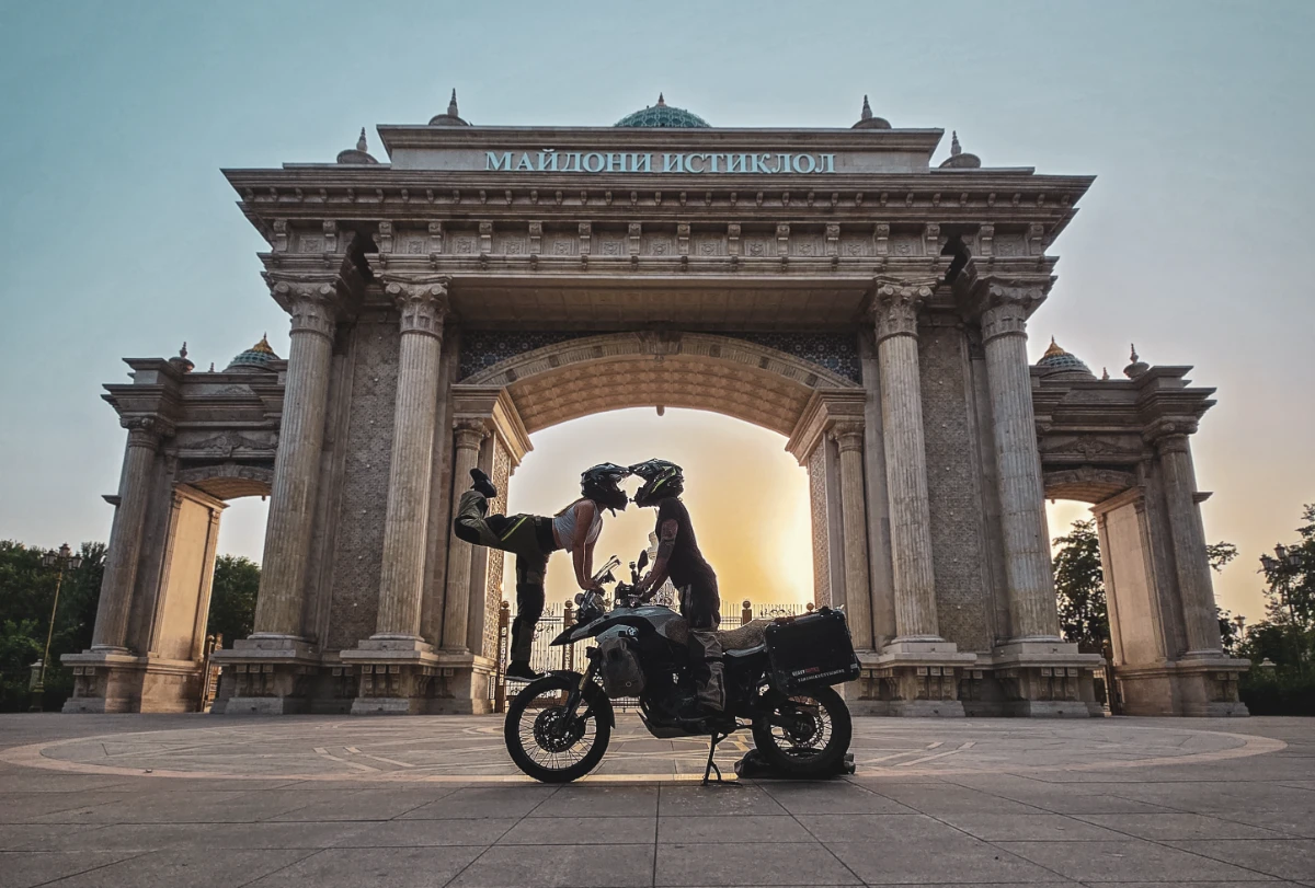
Additionally, Dushanbe surprised us with a partnership shoot for Samsung, new phones, a scorching afternoon in the city streets, and a Reel that ended up getting 1.2 million views. Somewhere between the GBAO permit queue and the Samsung phones nearly melting in the heat, we also visited the legendary Aziz at Bike House, the go-to mechanic for Pamir-bound riders. He found us a new chain guard, briefed us thoroughly on every stage ahead, and changed the tyres on our friends’ CRFs. We decided to push Falkor’s tyres all the way to Osh, a gamble that paid off beautifully (more on that later).
Finally, on the morning of August 3rd: five motorcycles rolling out of Dushanbe in convoy, heading southeast. The Pamir was waiting.
The Road Unfolds: Afghan Border, Falkor’s Tantrums & the First Dust
The road south from Dushanbe to Kulob is unremarkable, a 180-kilometre preamble at 46°C that feels like riding through an oven with a broken thermostat. We arrived in Kulob in the early afternoon, found an unexpectedly decent hotel with a courtyard for the bikes, and celebrated our arrival with the best possible reward: a 10-somoni watermelon from the market (roughly 80 cents). After weeks on the road, a cold watermelon shared between five riders in the shade feels like the greatest luxury on earth.
The following morning, we made our last stop at a proper 95-octane fuel station, after this, it gets complicated. We topped up every tank and every jerry can, did a final mechanical check, and hit our first GBAO military checkpoint at the entrance to the restricted zone. Seven puppies. Super friendly officers. Five minutes flat. Best checkpoint of the trip.
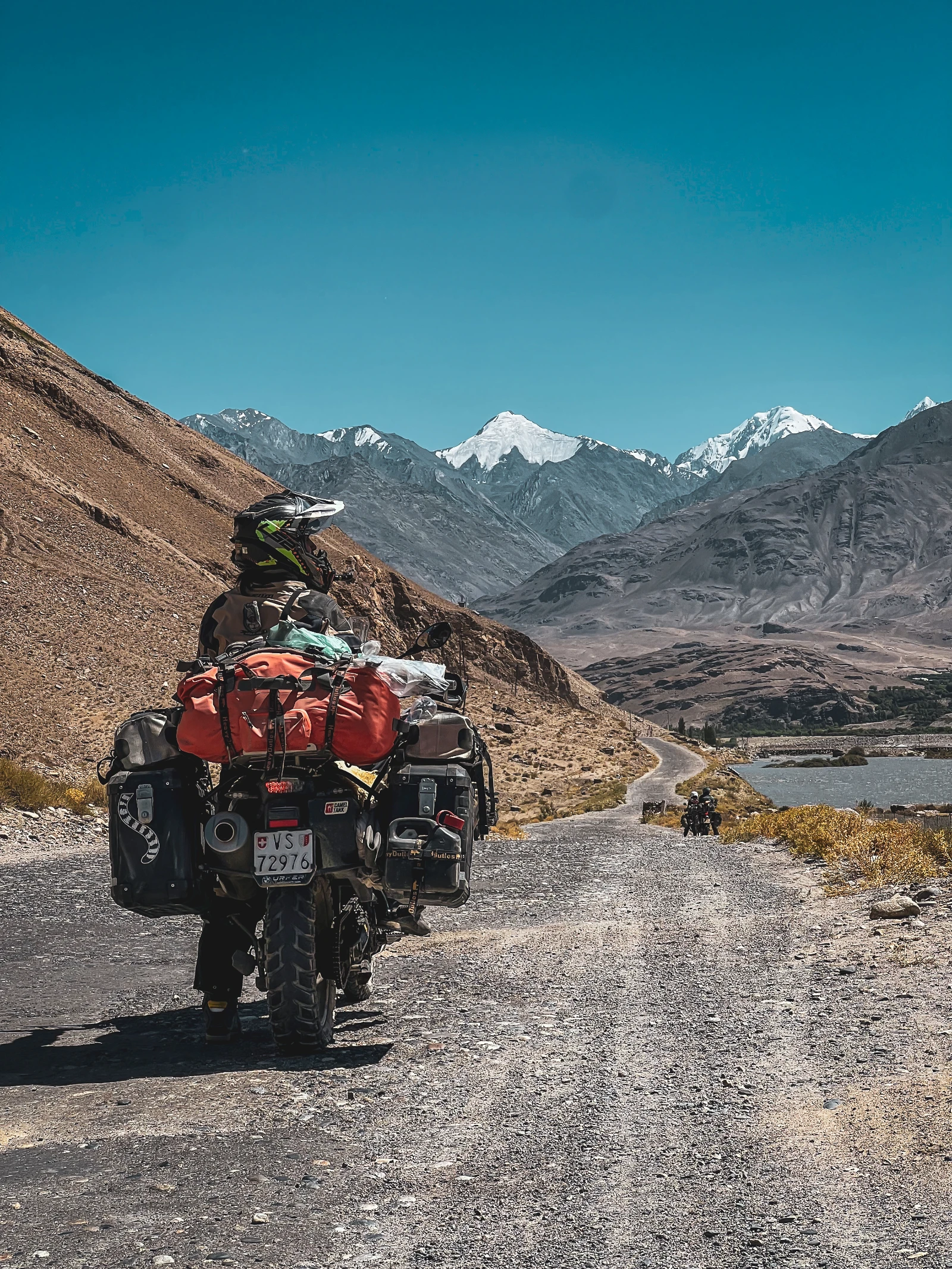
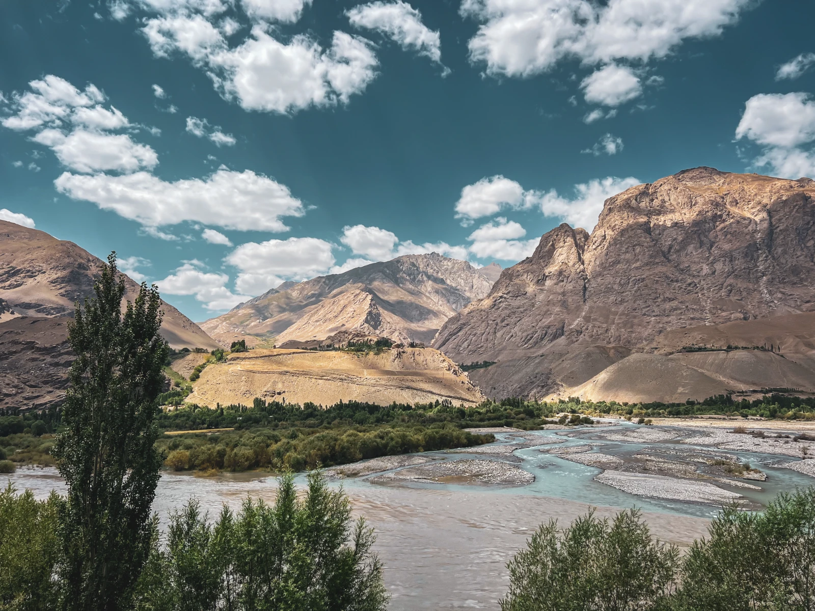
And then, the river. The Pyandzh River (Panj) appeared to our left and didn’t leave us for days. It is the natural border between Tajikistan and Afghanistan, and riding alongside it is one of the most quietly surreal experiences of the entire journey. On the opposite bank: Afghanistan. A narrow dirt track. Small villages. Occasional figures in the distance. Military patrols on our side, walking the road and waving as we pass. The border is a river. The river is just… there. And it changes everything about how you perceive the space you’re riding through.
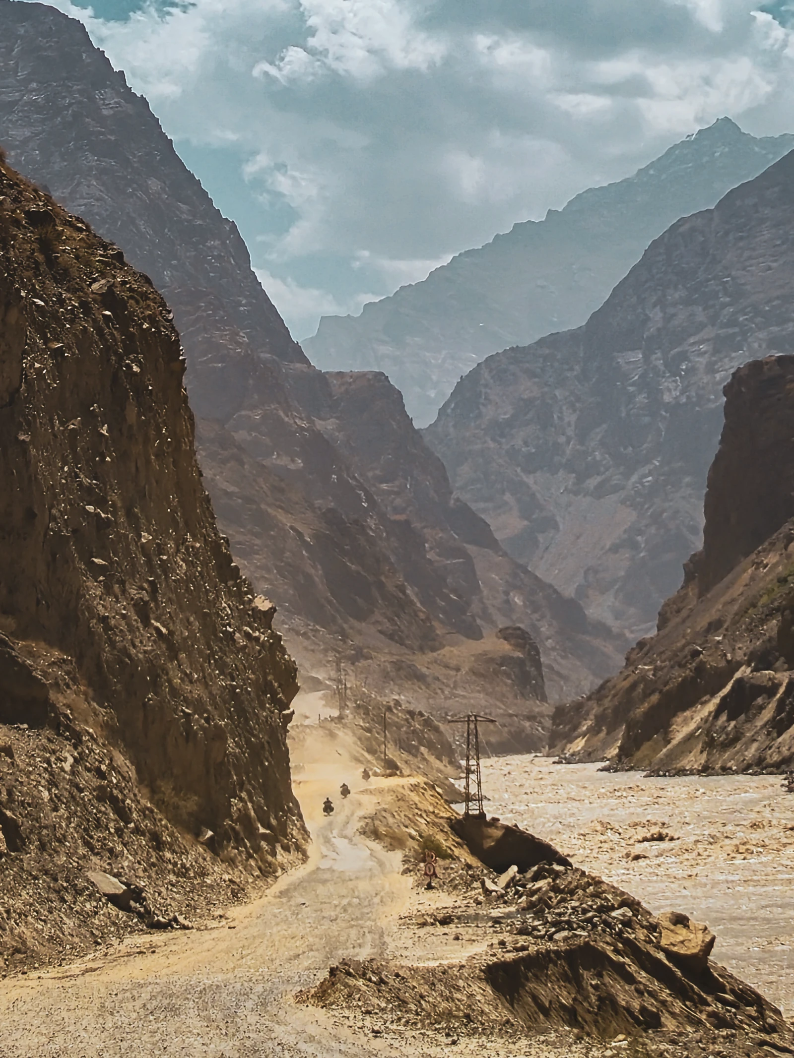
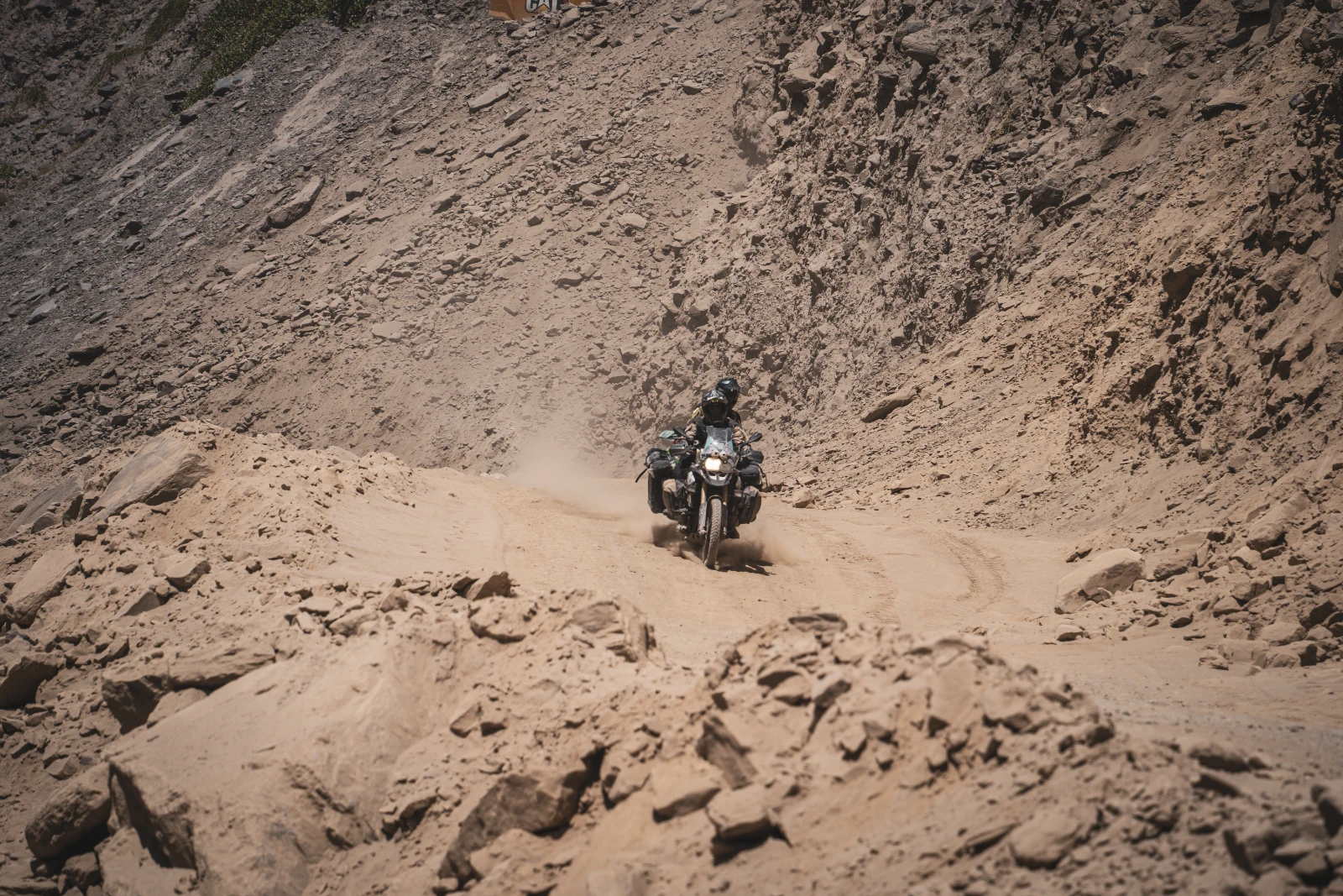
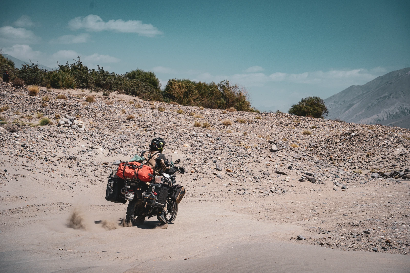
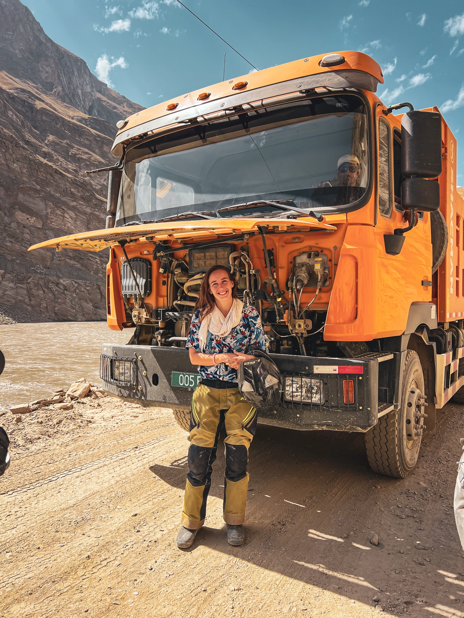
However, the road between Kalaikhum and Vamd was one of the most physically demanding days of the entire Pamir. A 155-kilometre stretch through active construction, bulldozers carving new road out of sheer rock faces, three mandatory stops where we waited in dust clouds so thick you couldn’t see your own handlebar. We breathed construction debris, watched trucks negotiate impossible angles above us, and sweated through our riding gear in heat that had no mercy. And yet: the mountains were extraordinary. Every pause in the dust revealed another impossible view.
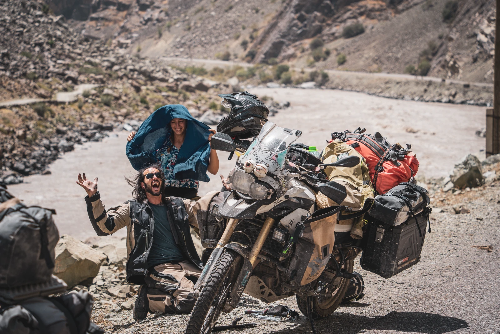
Falkor was not at his best. In the heat and altitude, he was stopping every 10 minutes, overheating, then restarting. Each time he shut down, our hearts dropped a little. We were at the very beginning of a route where the nearest garage was days away. We cleaned his air filters at every stop, gave him time to breathe, and talked to him quietly like the living thing he felt like. Come on, Falkor. You’re a Luck Dragon. Act like one.
Khorog & the Wakhan Valley: Afghanistan, Yurts and a Japanese Woman with a Donkey
After the brutal approach roads, Khorog, the capital of the Pamiri people, felt like an oasis. We chose the Traditional Pamiri House Homestay, run by the extraordinary Sharofat, whose warmth could heat a mountain village in January. Four trees, a hammock, a garden with actual grass (we hadn’t seen grass in weeks), and a niece who played piano like a concert performer in their living-room museum. We could have stayed a week.
Khorog is also the fork in the road: north on the M41 proper, or south into the Wakhan Valley, the narrow corridor that runs along the Afghan border for about 300 kilometres before reconnecting with the main highway near Murghab. The Wakhan is not on the official M41 route. It’s rougher, slower, less travelled, and, if you ask overlanders, the most spectacular section of the entire Pamir region.
We almost missed it. The morning of our planned departure, news reached us that a major flood had destroyed a village and the road was impassable. Several riders had turned back. We resigned ourselves to the main highway, and then, literally as we were mounting our bikes, Sharofat ran out of the guesthouse to tell us the road had reopened each morning before noon. We were on it within the hour. Sometimes the road decides for you.
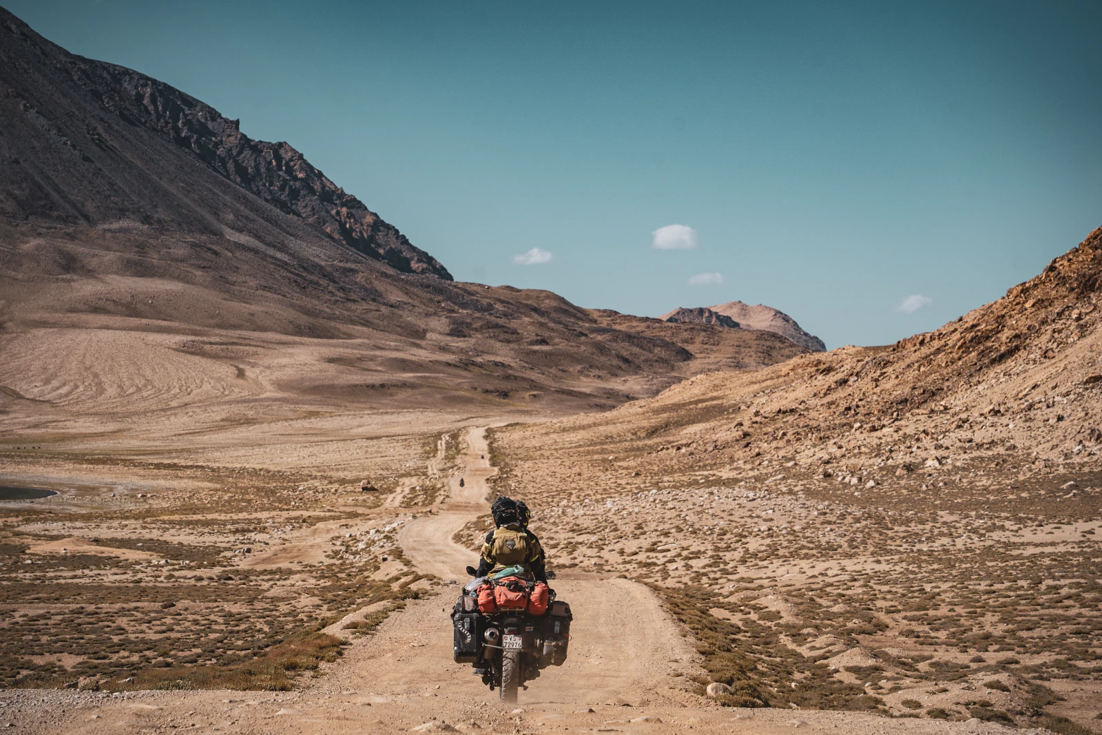
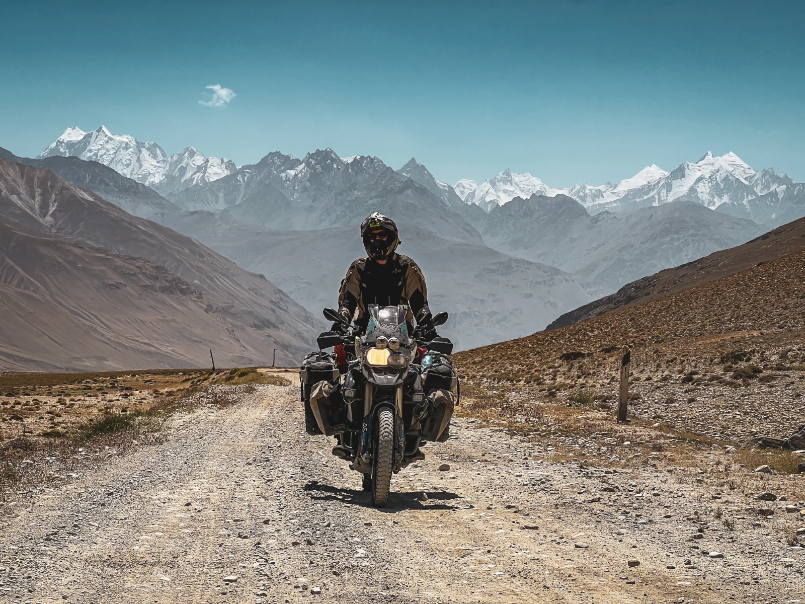
The Wakhan was everything we’d hoped for and more. The road traces the Panj River so closely you could throw a stone into Afghanistan. On the other bank: their version of the same mountains, their version of the same silence, just a different political reality. The contrast between the massive Tajik military presence on our side (friendly, always waving) and the barely visible footpaths and villages across the water was one of the most thought-provoking experiences of our four years on the road.
Hot Springs, River Crossings and a Japanese Woman with a Donkey
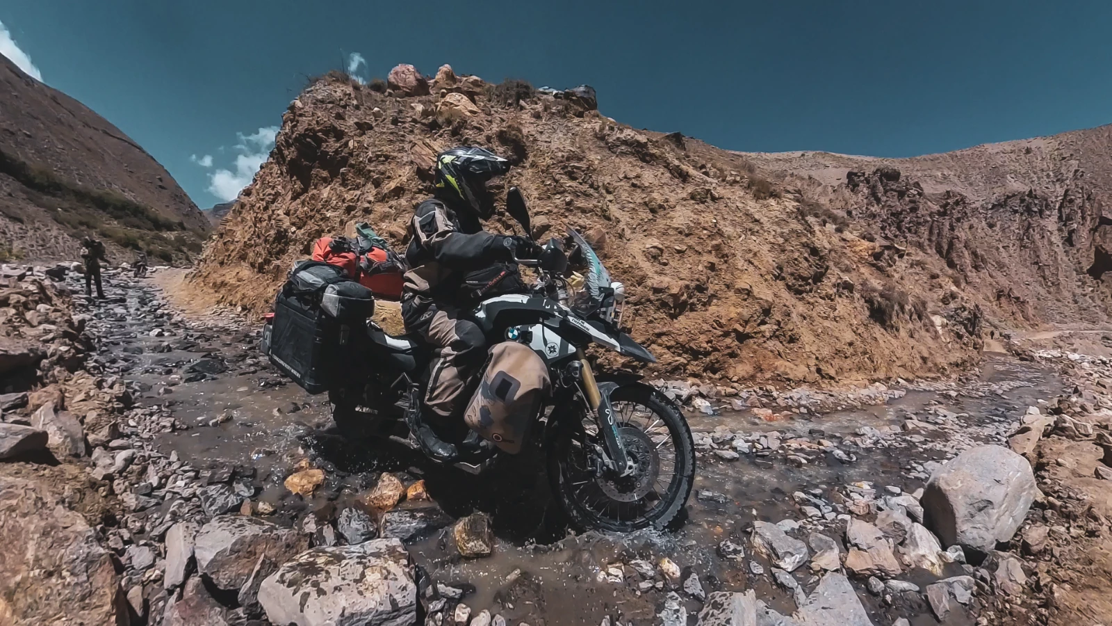
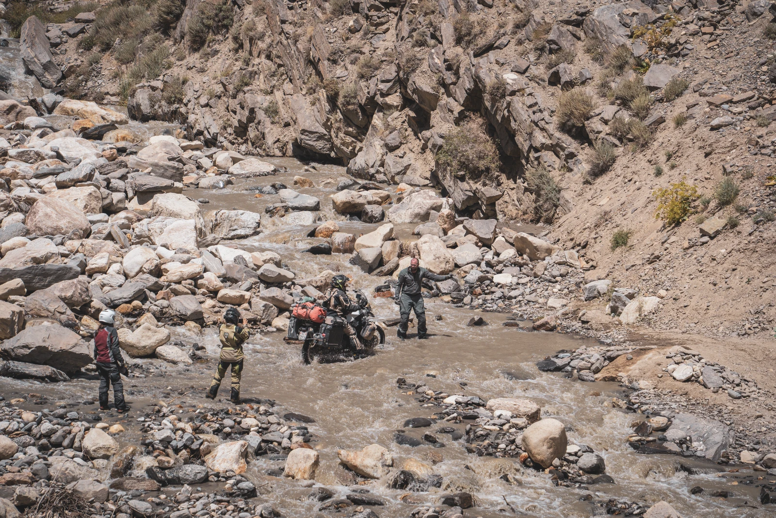
Furthermore, we stopped at hot springs, bathed in mountain water, got overtaken by rivers, and crossed a gué that had Sander doing a test run first while the rest of us held our breath. At a small guesthouse near Ishkashim, our host Sharofat (from Khorog) had managed to forward Natha’s forgotten sandals via a random driver heading our way. The mountains have a community network that WhatsApp could learn from.
And then there was Nana. A Japanese woman who had decided, somewhere along the way, to buy a donkey named Mishka and walk the Wakhan. We’d heard whispers about her from other travellers. On our riding day through those plains, we spotted her, actually marching with Mishka down the dusty track, serene as anything. We pulled over, said hello, lost about 10 minutes to laughter and disbelief, and rode on. The Wakhan does that to people. It makes the impossible feel perfectly reasonable.
The Afghan Market at Ishkashim: Worlds Collide on a Saturday
Indeed, every Saturday, on a strip of no man’s land in the middle of the Panj River, technically belonging to neither Tajikistan nor Afghanistan, traders from both sides of the border set up a market. It’s one of the most singular things we’ve seen in four years of travel: Afghans and Tajiks, side by side on neutral ground, trading goods that the border would otherwise prevent from crossing.
Walking in, we felt the weight of the moment. These people live in entirely different worlds, same mountains, same river, different everything else. Their traditional dress, the striking blue eyes that Marco Polo himself wrote about when he passed through these valleys, the absolute otherness of it, it was both humbling and beautiful. We were the tourists here, obviously. The stares were mutual.
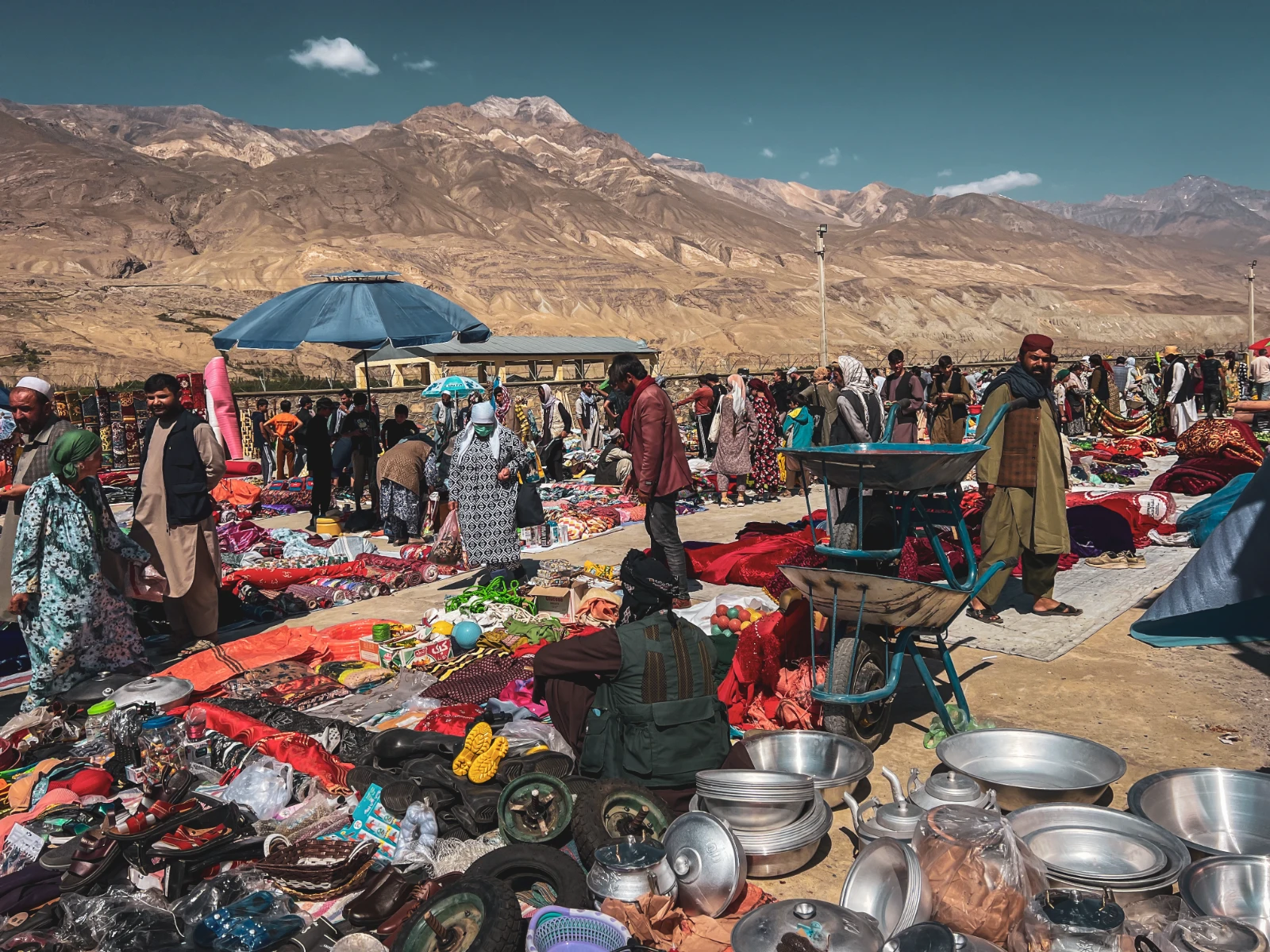
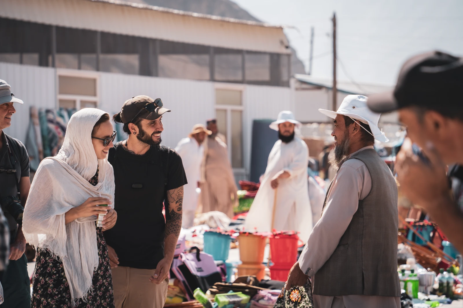
The Wakhan Corridor, one of the most unique geographic features in the world, exists because of a 19th century compromise between the British and Russian Empires during the « Great Game. » That thin strip of Afghan territory separating Tajikistan from Pakistan and China was drawn to keep two empires from touching. Standing on the market ground, both sides looking at each other across a piece of borrowed earth, that history felt very much alive.
We spent two nights nearby at Ren Guesthouse, clean, warm, excellent food, and genuinely restorative after the relentless Wakhan piste. Highly recommended if you’re planning this route.
How We Lost Our License Plate on the Wakhan, and What Happened Next
Picture this. You’ve just crossed a 4,320-metre col. The kind of col where breathing becomes an activity that requires conscious effort. The descent has shaken every bolt on the bike. You’ve been riding for hours through breathtaking, relentless mountain terrain, and you finally reach the valley floor, feel the tarmac under your wheels again, and think: we made it.
You reach for your camera. And then Vins looks back at the motorcycle and goes very quiet.
The license plate was gone. Somewhere on those 4,320 metres of corrugated piste, the road had simply claimed it. Falkor, the Luck Dragon, was now officially an outlaw.
Going back was out of the question, the route was brutal and uncertain, and we had no idea where exactly it had fallen. Vins posted the plate number on every overlander Facebook group and WhatsApp channel he could find, hoping that by some miracle someone would spot a Swiss Valais plate lying in the Tajik dust. Then we rode on to Alichur, then Murghab, and started problem-solving.
Murghab: Making a Fake License Plate in a Mad Max City
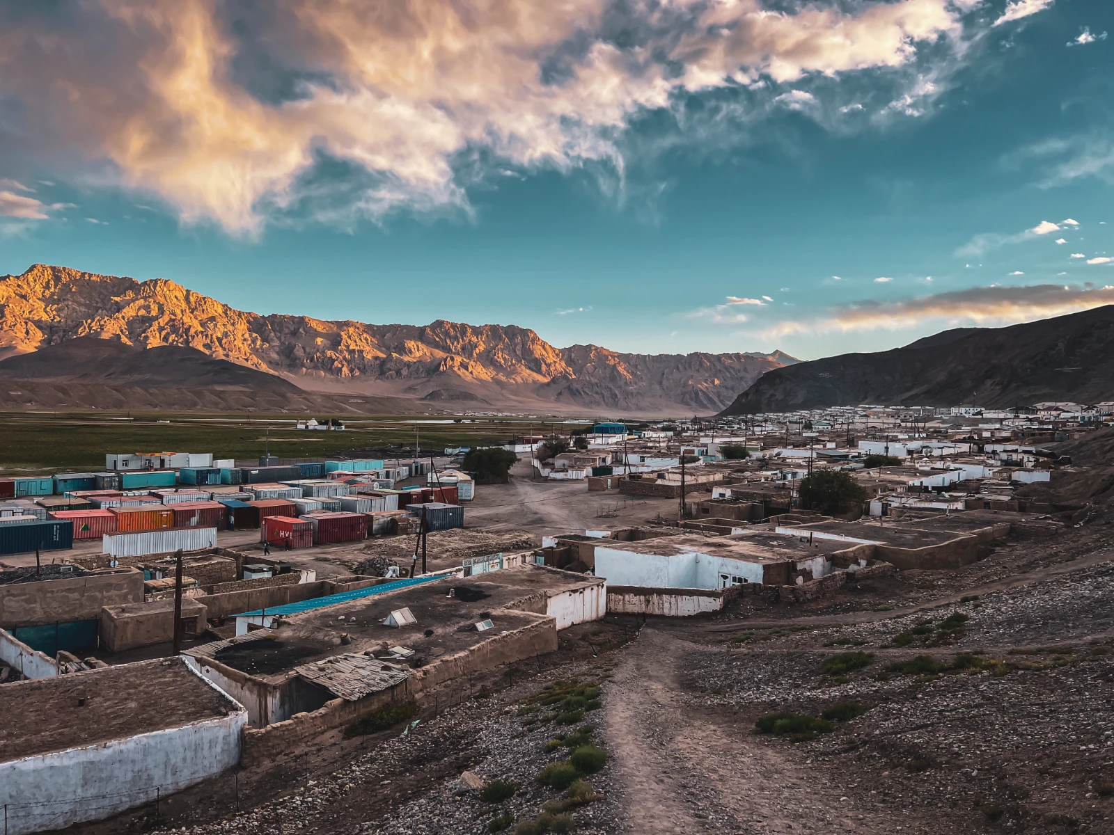
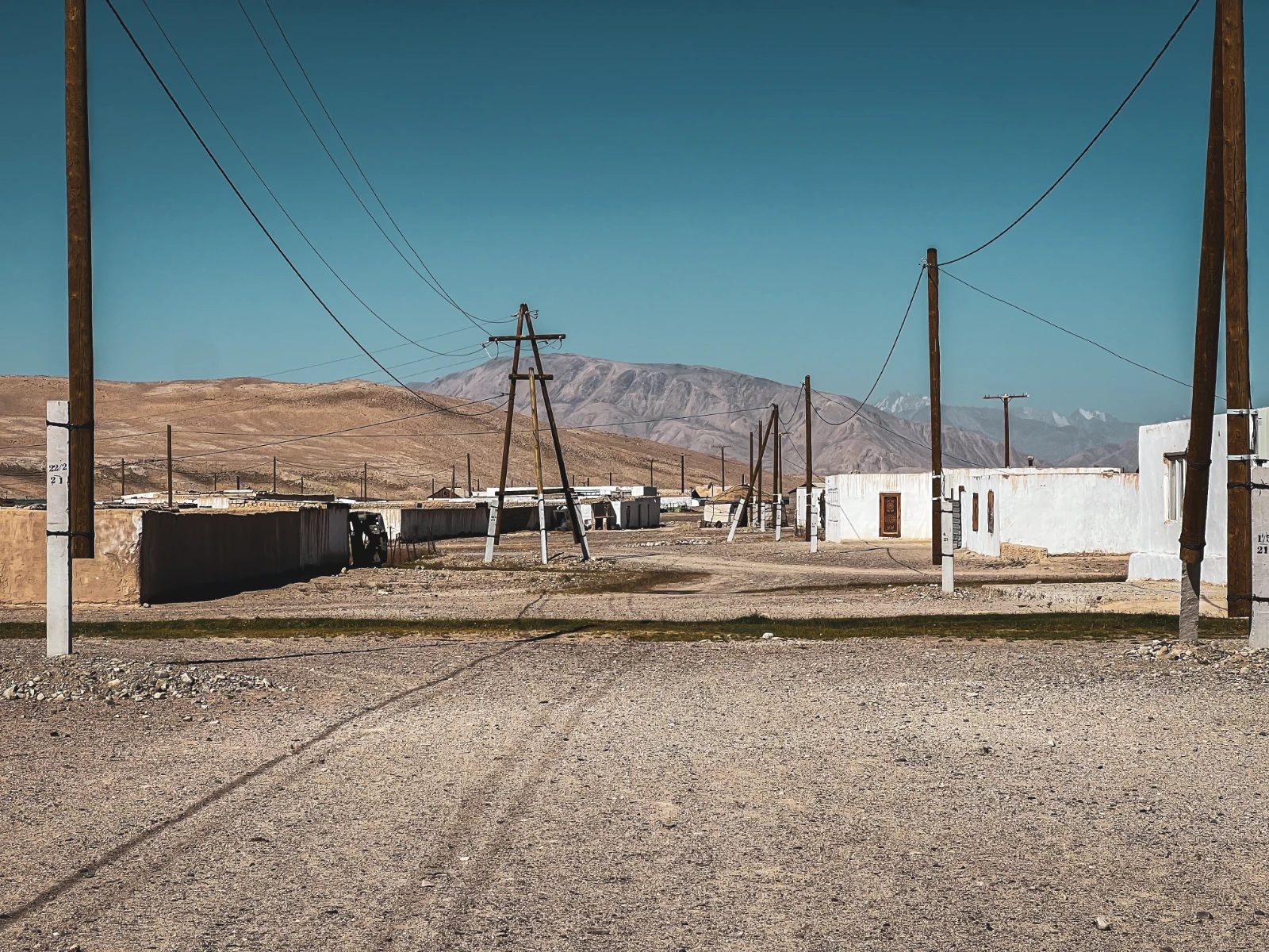
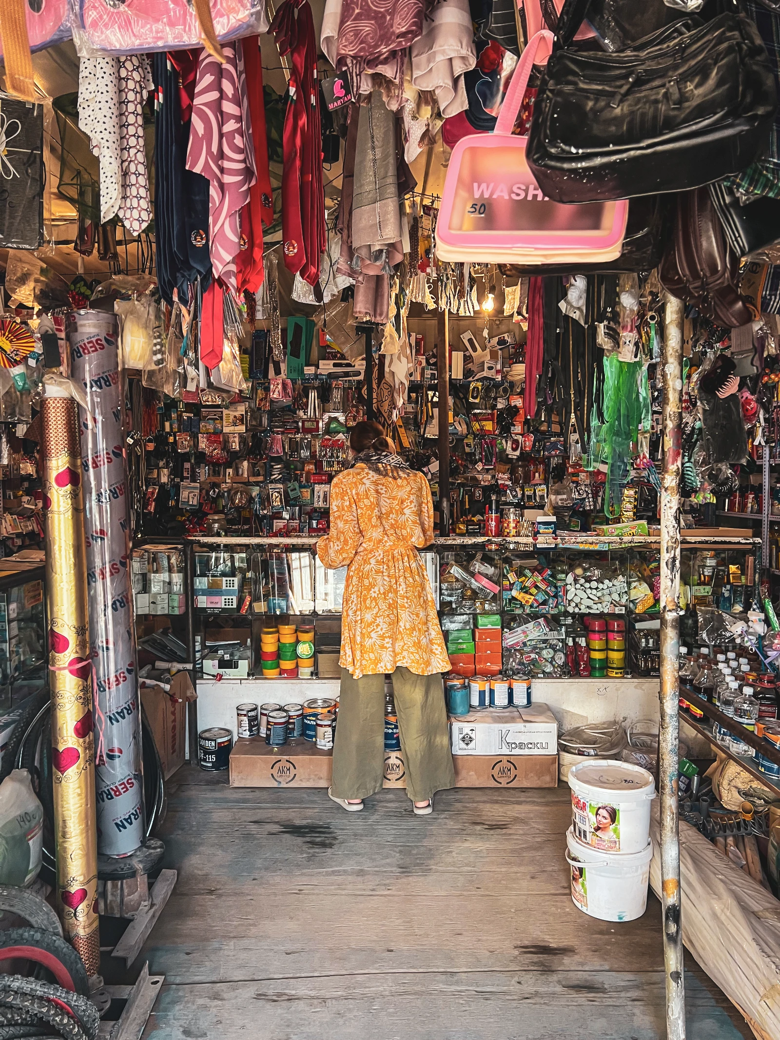
Murghab is the kind of place that looks like a film set for a post-apocalyptic Western. Shops built into shipping containers. Yak herds wandering the main street. Dust on everything. We loved it immediately.
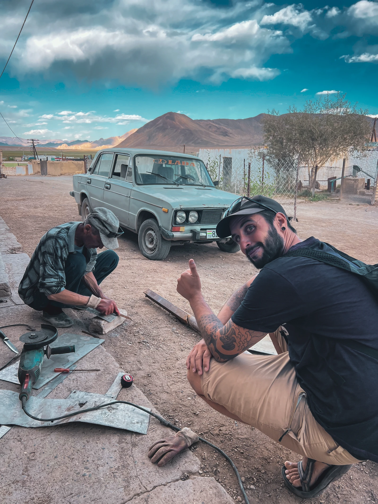
We had a few days before the Kyrgyz border, which gave us exactly enough time to find a solution. We located a local craftsman, a father helped by his daughters, who had an aluminum cutter and the patience to listen to two frantically gesturing Europeans explain what a Swiss Valais license plate looks like. For the paint, we bought spray cans from the market. For the finishing touches: cardboard stencils, a steady hand, and the kind of creative desperation that only remote mountain travel produces.
Natha spent half a day reproducing the plate. The Valais cantonal coat of arms, the distinctive red and white stars, was the hardest part. The finer details were a bit… impressionistic. But the overall effect? Remarkably convincing.
In a move that seemed very logical at the time and very questionable in retrospect, we decided to go to the Murghab police station to report the lost plate. You know. The Swiss thing to do. Fill a form. Get a receipt. Be thorough.
The policewoman who received us clearly struggled to understand what on earth two foreign motorcyclists wanted from her. After some laborious translation-by-gesture, she concluded, incorrectly, that we wanted her to call the Tajikistan-Kyrgyzstan border post to warn them that a motorcycle without a plate was coming.
We frantically tried to correct this. « No, no, we have a plate! Look! » And Vins pulled out his phone to show her a photo of our freshly-made fake plate.
There was a pause. The policewoman studied the image carefully. Then she looked up, and congratulated us on the quality of our forgery. We had just proudly presented evidence of document falsification to a law enforcement officer. She seemed genuinely impressed. She stamped nothing, called no one, and sent us on our way.
We left a sheet of A4 with the plate number and our contact details, just in case. And then we rode out of Murghab with a handmade aluminum plate, the blessing of an amused policewoman, and a story we knew we’d be telling forever.
However, three weeks later, Vins received a message. A Dutch couple travelling by van through the Wakhan had found our plate, lying in the dust exactly where we’d lost it. They had picked it up as a souvenir, not knowing who it belonged to. But they recognised the Valais coat of arms immediately: they were regular climbers in Zinal, a village near our old home in Sierre, Switzerland. They kept it, intending to return it one day. Then they saw Vins’ post on social media and got in touch in Osh.
As a result, we made a Reel about the whole thing. It got 6.1 million views, our most watched piece of content ever. And in the weeks that followed, one particular new follower caught our attention: Usain Bolt, the fastest man in history, had apparently watched the story of our lost license plate and decided we were worth following.
Murghab to Ak Baital: Welcome to the Roof of the World
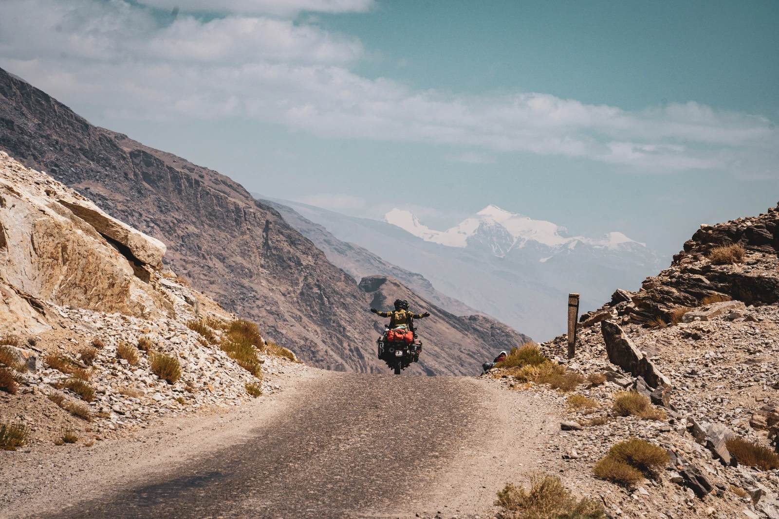
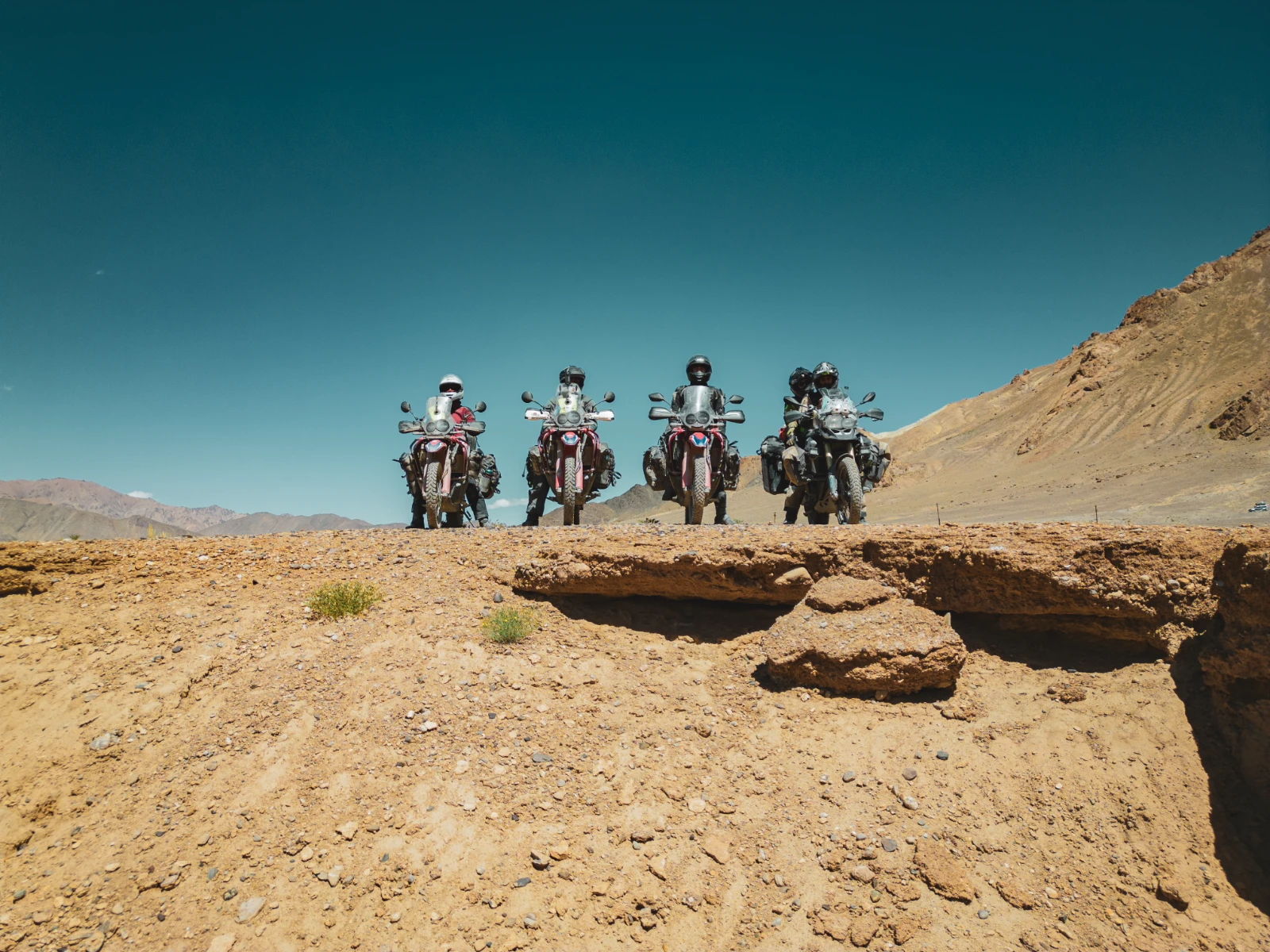
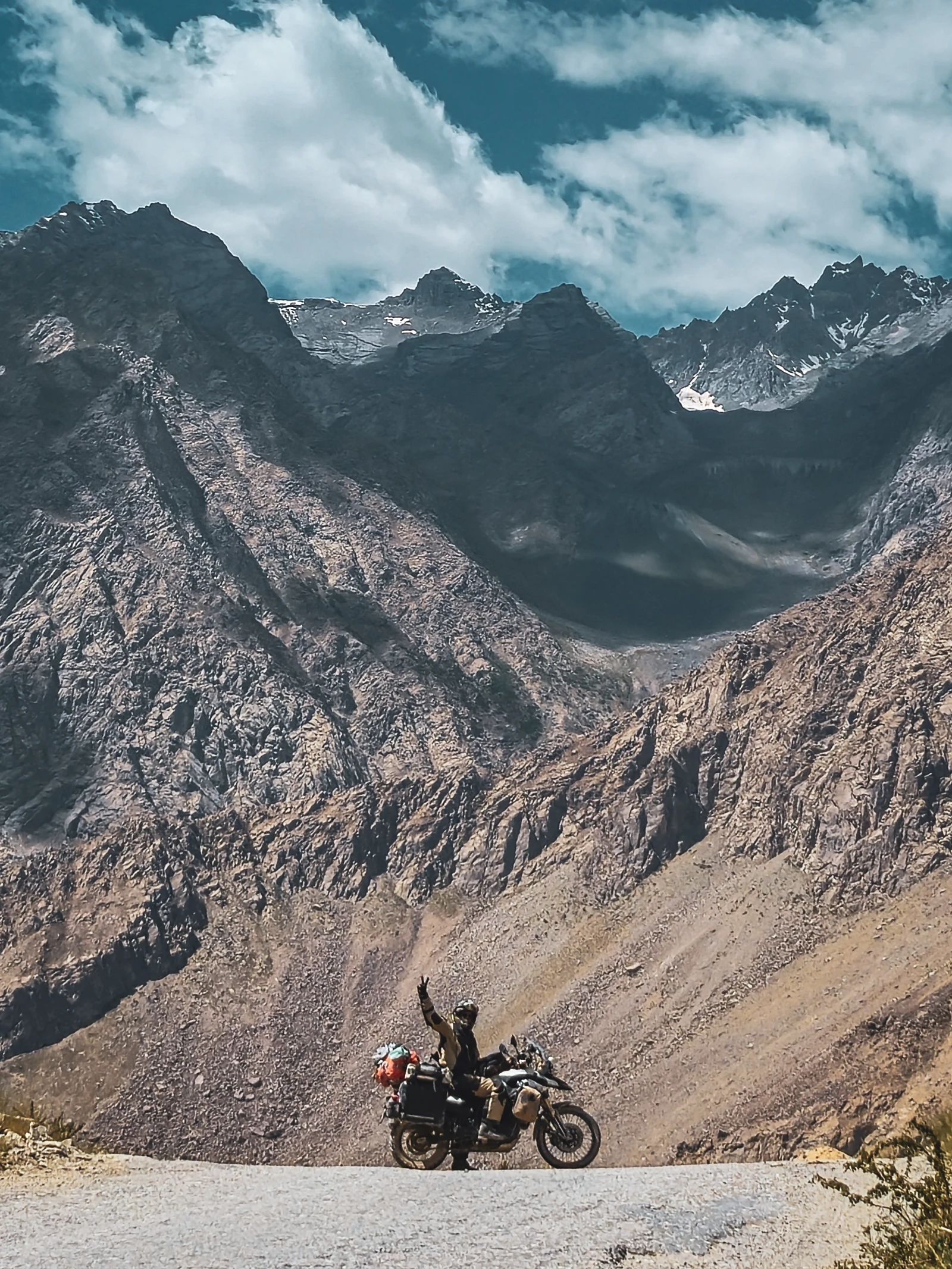
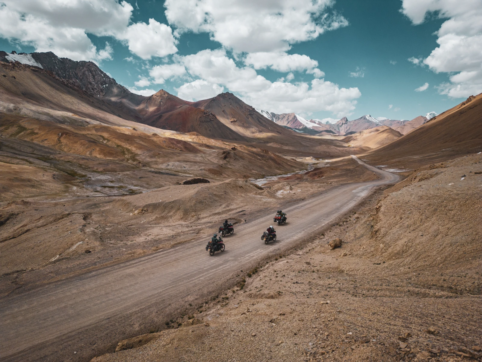
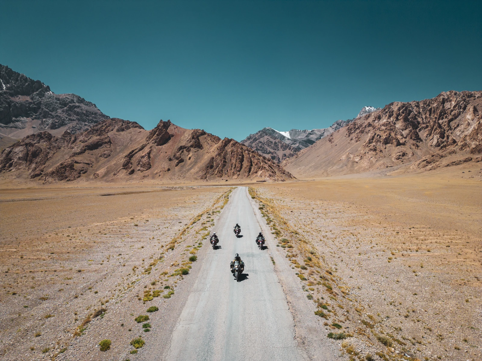
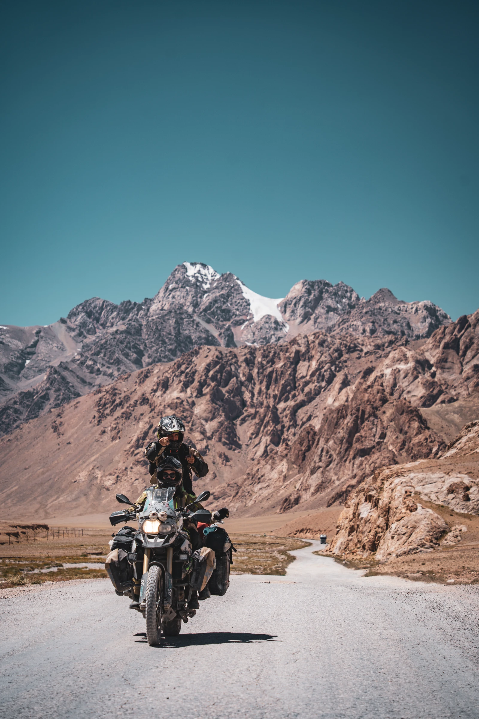
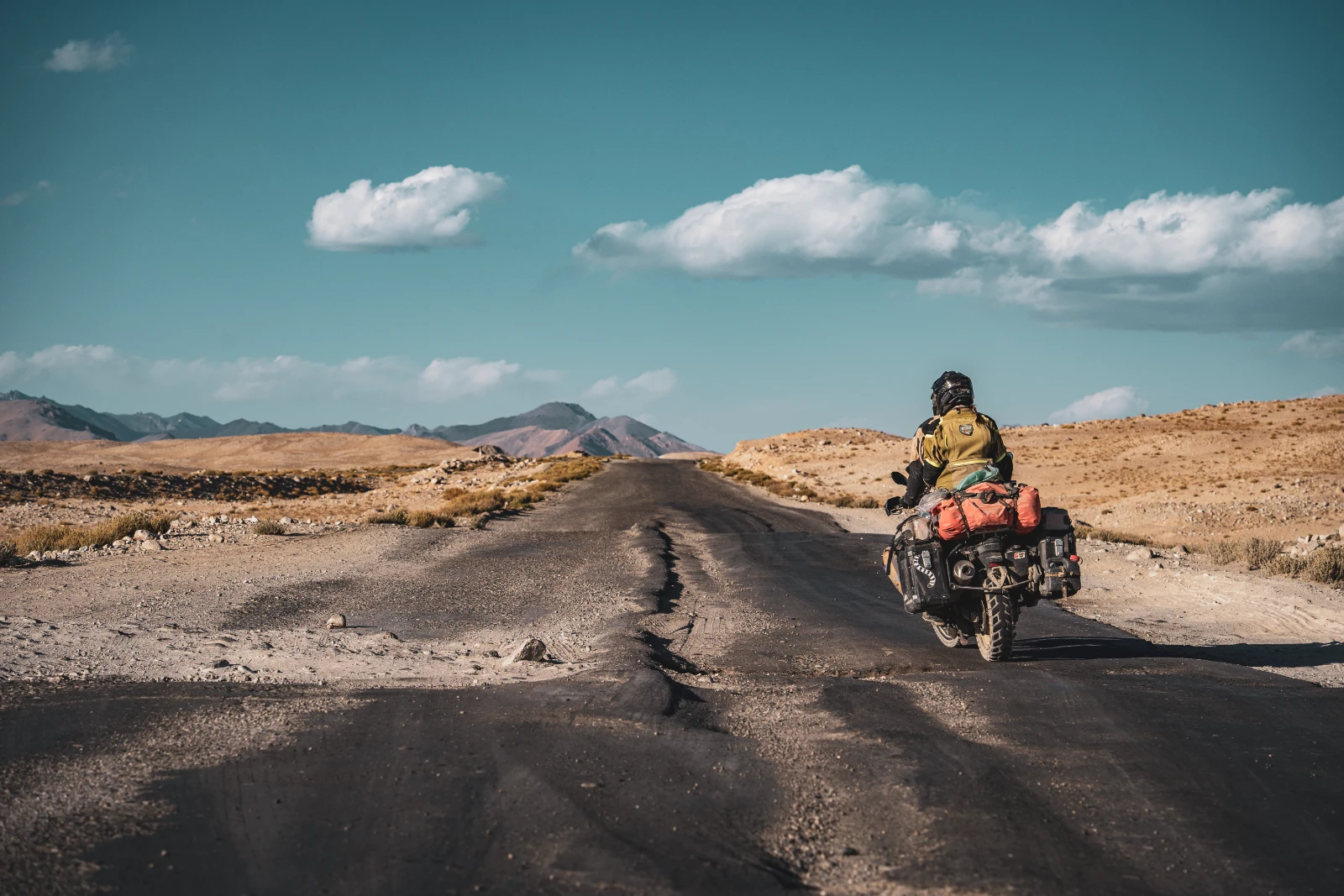
Beyond Murghab, however, the landscape changes completely. The narrow valley walls open up into something vast and almost incomprehensible: the Pamir Plateau. A high-altitude desert that feels less like Central Asia and more like the moon, if the moon were occasionally crossed by yak herds. The road improves dramatically. The air gets thin. And the colours, red mountains, ochre plains, improbable blue lakes, become almost hallucinatory in their beauty.
For instance, leaving Alichur in the morning, we spotted a large herd of yaks grazing beside the road. We stopped and spent a completely unnecessary and entirely necessary fifteen minutes just watching them. There is something deeply grounding about being at 4,000 metres in the middle of nowhere, watching animals that look prehistoric, on a road that was a Silk Road trade route centuries ago. Everything feels very large and very old, and you feel very small and very temporary, and somehow that’s exactly the right feeling.
Ak Baital Pass: 4,655 Metres, the Highest Point
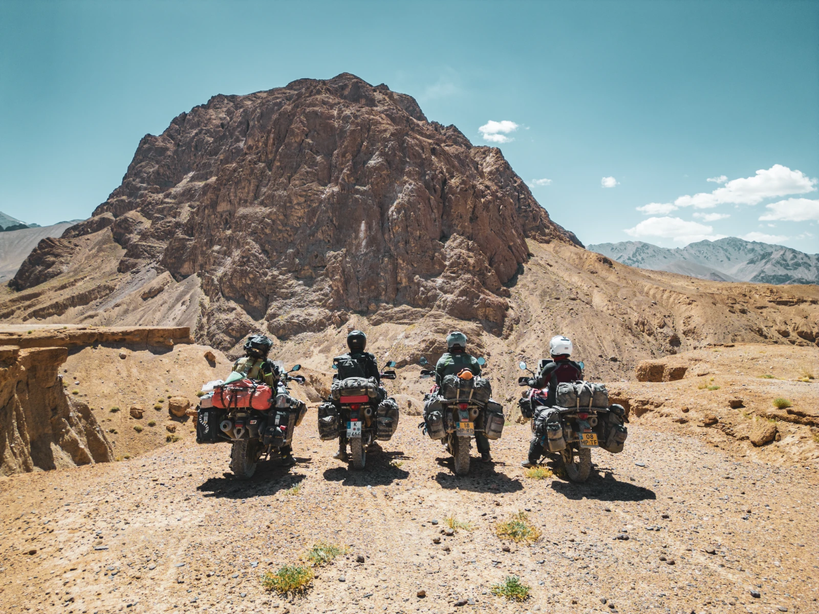
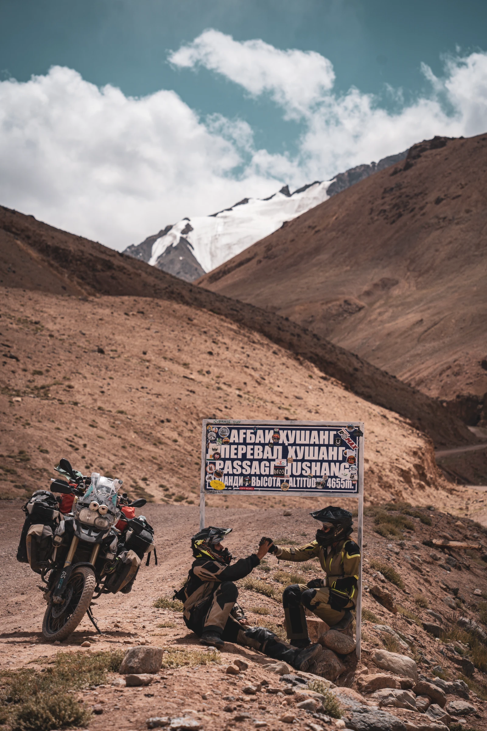
The Ak Baital Pass at 4,655 metres is the highest point of the Pamir Highway, and one of the highest navigable mountain passes in the world. The climb is gradual and scenic, crossing a landscape that feels genuinely other-worldly. At the top, each photo requires pausing to breathe first. We laughed at ourselves for getting winded just raising our arms for a shot.
We kissed at the summit. Of course we did. You kiss at 4,655 metres. It’s a rule.
A massive raptor circled overhead as we stood there, five riders in full gear on the roof of the world, grinning like idiots. The silence was so complete it rang. Below us in every direction: red and brown mountains, no trees, no buildings, nothing that suggested the presence of other humans except the thin strip of asphalt we’d arrived on.

After the pass, the descent brought us to the Karakul Lake area, one of the most strikingly blue lakes we’ve ever seen, set against the dark red of the surrounding mountains. And then the final stage: a long, beautiful roll toward the Kyrgyz border, passing through landscapes that had all the grandeur and none of the crowds of better-known mountain regions.
Karakol: Swimming at 4,000 Metres & Saying Goodbye to Seb
Karakol, at 4,000 metres altitude, was our last stop in Tajikistan. A tiny Kyrgyz village on the border’s edge, a reminder that political lines don’t follow cultural ones. The family who hosted us was warm, funny, and had children who wanted to play frisbee indoors, which is perhaps the best way to spend an evening at altitude when you know tomorrow brings a border crossing and a new country.
We marked the moment the only way that made sense: we all jumped in the lake. Swimming at 4,000 metres above sea level. The water was so cold it felt like a physical shock. We screamed. We laughed. We stayed in longer than we should have. Sander, Iris, Vins, Natha, four people who hadn’t known each other a few months earlier, floating in a glacial lake near the top of the world.
It was also our last riding day with Sebastian. Six weeks of road together, from that random meeting at the Kazakh-Uzbek border crossing to this lake at 4,000 metres. That’s what travel does: it takes strangers and makes them people you genuinely grieve leaving behind. We took a lot of photos. We said goodbye too many times. Then we rode toward the border.
The Border, the Watch & the Green Steppes of Kyrgyzstan
The Kyzyl-Art border crossing between Tajikistan and Kyrgyzstan is one of the more unusual crossings in Central Asia. It’s technically only accessible to foreigners with a special permit, locals on both sides cannot cross here freely, which creates a bittersweet quality to the experience. Our Kyrgyz host family in Karakol, who were ethnically Kyrgyz, could not follow us through this gate to visit family on the other side. The border that exists for geopolitical reasons doesn’t care about families. One of those quiet injustices that travel makes uncomfortably visible.
The Corrupt Officer, the Watch and the Green Steppes
We’d been warned about a customs officer on the Tajik exit side who invents a « missing receipt » for vehicle import and demands a €10 « fee » to let you leave. Sure enough, there he was. The four of us (Sander, Iris, Vins, Natha) held firm together: no receipt, no payment, please call the entry border to verify. He grumbled at length, stamped our papers, and let us through. Strength in numbers.
On the Kyrgyz side, a small moment that undid us. While waiting in the queue to have passports stamped, Natha noticed a Swiss train-station watch on the wrist of a fellow traveller, part of the Mongol Rally group we’d crossed paths with. She mentioned, offhandedly, the wave of homesickness it triggered. He unclasped it and handed it to her: « It’s yours. » Natha cried. We all cried a little. After three years on the road, a Swiss watch is also a piece of home.
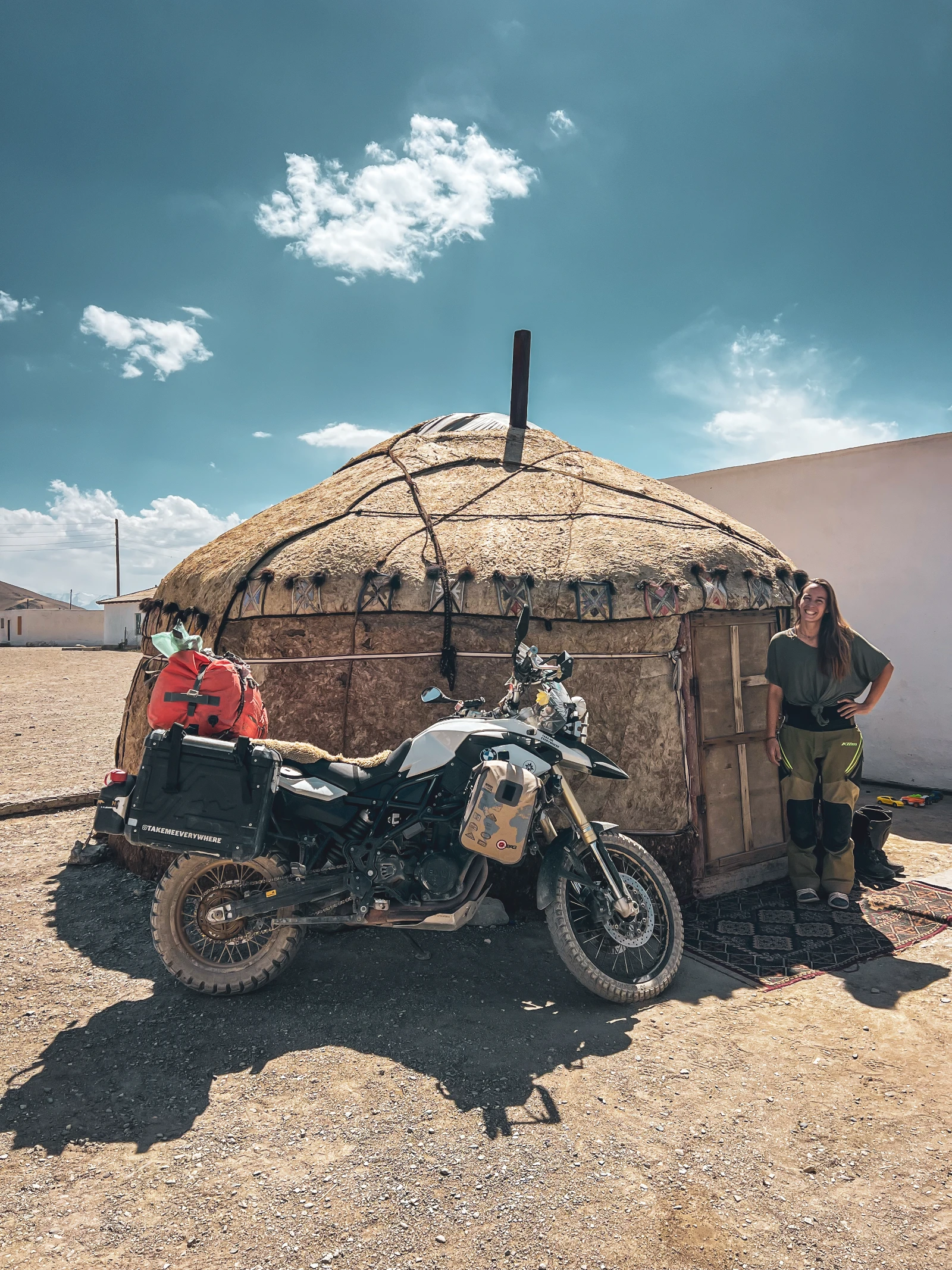
And then, immediately, Kyrgyzstan opened. The same mountains. Different palette. Green. Lush valleys, horses everywhere, yurts on every hillside, golden marmottes watching us from their burrows. We had arrived in what people call the Switzerland of Central Asia, and they’re not entirely wrong.
Lenin Peak & the Steppes: Camping Under the World’s Most-Climbed 7,000-Metre Mountain
Wild Camping at the Foot of a 7,000-Metre Giant
Our first night in Kyrgyzstan was spent wild camping on a hillside at the foot of Lenin Peak (7,134 metres), the most climbed 7,000-metre mountain in the world, straddling the Tajik-Kyrgyz border along the Trans-Alai range. We didn’t climb it, obviously. We parked Falkor on a ridge, set up our tent, cooked dinner in the fading light, and spent the evening just staring at it.
For the first time on this journey, Vins rode off-piste in the steppe, no GPS, no trail, just the land in every direction and the freedom to choose any line. This is something the Pamir and its surroundings do to you: they recalibrate your sense of scale and possibility. The steppe doesn’t ask you to follow a road. It simply is, in every direction, forever.
Marmots. Everywhere. Golden, fat, hilariously suspicious marmots emerging from holes to assess whether Falkor constituted a threat, deciding he did not, then retreating again. Wild horses in the valley below. A herd of camels in the middle distance. We rode toward Lenin Peak’s base camp, through valleys that felt like Windows XP desktop backgrounds come to life, and camped again under a sky so clear and so crowded with stars it barely felt real.
Osh: The Plate Returns, the Feria Almost Kills Us
Osh, Kyrgyzstan’s second city, marked the official end of the Pamir Highway. We rolled in on August 18th, after 16 days that had covered somewhere in the region of 1,500 kilometres, though distances on the Pamir Highway are measured less in kilometres than in experiences.
Falkor in Perfect Health and the Return of the Lost Plate
Falkor got a thorough check at two reputable local mechanics. The verdict: everything is fine. Tyres good. Chain good. Engine good. After the dust, the altitude, the flooding, the corrugated tracks and the overheating episodes of the Wakhan, the old BMW F800 GS had taken everything the Pamir could throw at him and arrived in Osh without a single mechanical failure requiring repair. We could have cried. We might have, a little.
This is also where the lost license plate story had its final chapter. Days after arriving in Osh, the Dutch couple who had found our plate in the Wakhan drove into the city and handed it back to us in person. Somehow, through a Facebook post, a shared love of climbing in the Swiss Alps, and the peculiar interconnectedness of the overlander world, a piece of Valais metal that had been lost at 4,320 metres in the Tajik mountains made its way back to its rightful place on Falkor’s rear end.
Osh also gave us our scariest non-road experience of the trip: a fairground attraction, a massive pendulum ride over a river, that we boarded in a moment of post-Pamir euphoria and immediately regretted. The harness on Vins’ seat didn’t close properly. The operators were primarily concerned with their music playlist. And the ride itself swung over the river at speed, nearly inverted, with the structural confidence of something assembled in 1987 by someone who’d since retired. We did not die. We also will never do that again.
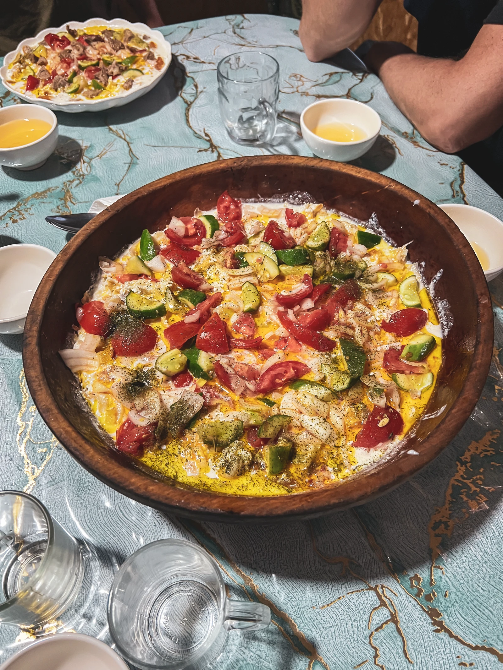
The Kurutob: Tajikistan’s National Dish (and the One Vegetarian Win of Central Asia)
Central Asia is not easy territory for vegetarians. Meat is central to the culture in a way that makes avoiding it feel almost rude. But Tajikistan gave us one reliable salvation: the Kurutob (also written Qurutob). A bed of torn flatbread soaked in sour milk (kurt), topped with vegetables, onion, and a drizzle of oil, it’s earthy, filling, and deeply satisfying. We ate it in every city. It was available without meat in most places. It became our anchor dish.
Our final Kurutob was eaten in Murghab, just before leaving, a small ritual to mark the end of our Tajik chapter. If you’re planning the Pamir Highway, order the Kurutob wherever you see it. You will not regret it.
Everything You Need to Know Before Riding the Pamir Highway
The Pamir Highway rewards those who prepare thoughtfully but doesn’t punish those who improvise, as long as your bike is solid and your mind is flexible. Here’s everything we wished we’d had in one place before we left.
| Topic | What You Need to Know | Status |
|---|---|---|
| GBAO Permit | Mandatory for the Pamir region. Obtain at the Ministry of Foreign Affairs in Dushanbe, usually ready same day. Cost ~$20. Print 10+ copies for checkpoints. Also register your stay within 72 hours of arrival in Tajikistan (guesthouse usually handles this). | Required |
| Fuel | Last reliable 95-octane in Kulob. After that: 80 or 92 in Khorog and Murghab. Carry a 5–10L emergency reserve. Fuel availability is inconsistent, never leave a station without a full tank. Murghab is your last stop before Osh. | Plan carefully |
| Cash | Withdraw enough Tajik Somoni in Dushanbe or Kulob. ATMs are rare after this point. Some Khorog banks work, but plan for 2 weeks cash-in-hand. Murghab: local money exchange available, rates vary. | Cash only |
| Mobile / SIM | Tajik SIM (Beeline or Tcell) with data for the early stretches. Signal disappears past Khorog. Offline maps (Maps.me or OsmAnd) are essential. Download the entire region before leaving Dushanbe. | Prepare offline |
| Accommodation | Homestays (guesthouses) available every 50–100 km on average. Prices rise with altitude and remoteness (expect 15–40€/night including dinner). Wild camping is excellent and common. Ren Guesthouse (Ishkashim area) and Green House Hostel (Dushanbe) are top picks. | Easy to find |
| Kyzyl-Art Border | TJ→KG border only open to tourists with a pre-registered entry (your name must be in the customs book). Contact agencies or hostels in advance. The crossing is dry and easy in early morning. Watch for corrupt customs officers asking for fees, hold firm and ask them to call the entry border. | Pre-register required |
| Best Time | June–September. July and August are peak season (warmest, most stable). June has more snow on high passes. September is beautiful but nights get cold fast. We rode in August, ideal. | July–August |
| Altitude | You’ll spend days above 3,500m. The plateau averages 3,600–4,200m. Highest point: Ak Baital at 4,655m. Altitude sickness is possible, acclimatise in Dushanbe/Khorog before pushing high. Hydrate constantly. Take it slow on the passes. | Acclimatise first |
| Bike Mechanics | Service your bike fully before Dushanbe. Visit Aziz at Bike House in Dushanbe, he knows the road like no one else and can source parts. After Khorog, you’re essentially on your own. Carry basic tools, tire plugs, zip ties, and spare cables. | Prep in Dushanbe |
The Camera That Survived the Pamir: Insta360
We documented this entire journey with our Insta360 cameras, mounted on Falkor, worn on our helmets, held out over cliffs at 4,600 metres. The Pamir is brutal on equipment: dust, vibration, temperature swings, occasional rivers. Our Insta360 never missed a beat. As official Insta360 affiliate partners, we can offer you an exclusive discount, use our link below.
Read our full review: Best 360 Camera for Motorcycle Travel →
📷 Shop Insta360, Exclusive Discount →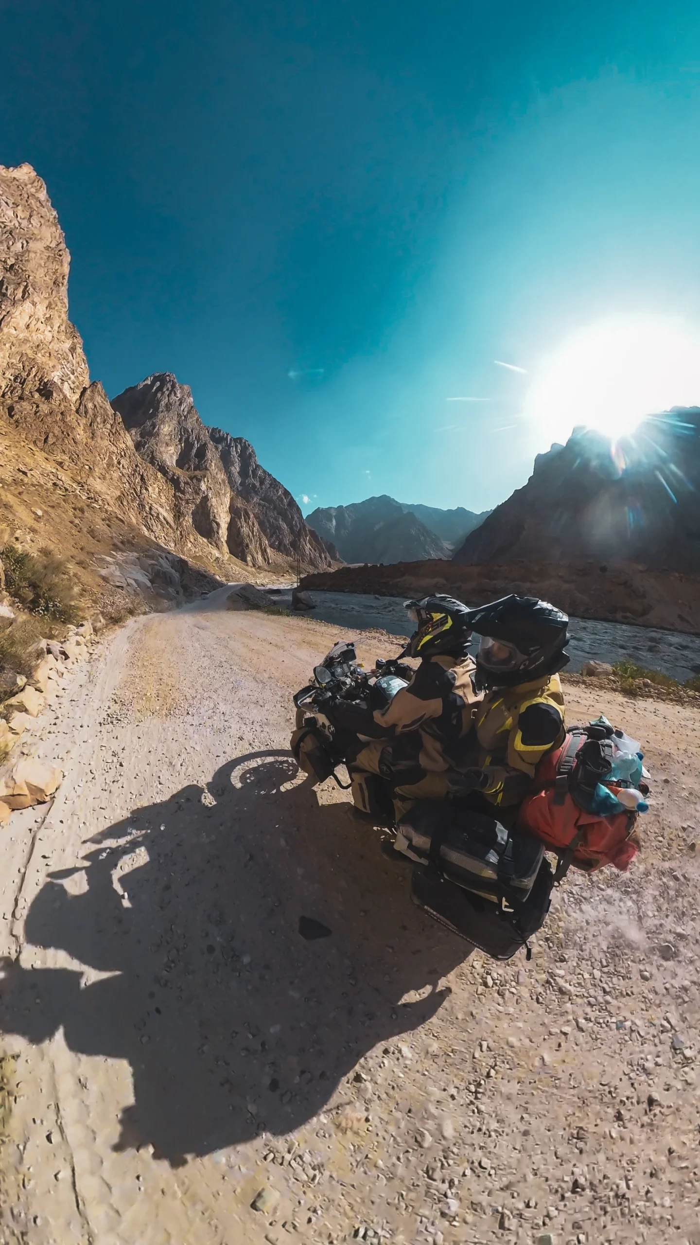
Tyres: Why We Have Had Zero Punctures in 4.5 Years
On a route like the Pamir Highway, tyre choice is not a detail, it’s a decision. We ride on Heidenau K60 Scout tyres, and in 4.5 years and 115,000+ kilometres of travel across Europe, the Caucasus, Central Asia and China, including the Pamir Highway in its entirety, we have had zero punctures. Not one. On roads that regularly chew through adventure tyres in a week.
We decided to push our existing K60 Scouts all the way from Dushanbe to Osh rather than replace them early. They made it without a single issue. The K60 Scout is a 50/50 tyre that performs exceptionally well on both tarmac and off-road, exactly what the M41 demands, which alternates between reasonable asphalt and challenging piste throughout.
📍 Navigation on the Pamir: What We Wish We Had
On the Pamir Highway, your phone is your only navigation tool. However, in direct sunlight at altitude, smartphones overheat constantly. Ours shut down multiple times on the most critical stretches, precisely when we needed them most. The heat, the vibrations, the sun exposure at 4,000 metres, it’s a real problem that no phone case fully solves.
Today, we ride with a Carpuride W702 Pro, a dedicated wireless motorcycle navigator that mounts to the handlebars and connects to our phone via Bluetooth. It handles heat far better than a phone, stays readable in full sun, and keeps navigation running even when the phone itself has given up. On a route with zero mobile signal for days, having a dedicated screen with downloaded offline maps is simply invaluable. We would have loved this on the Pamir.
Read our full review: Carpuride W702 Pro Review →
Get 30% off on the entire site with code TAKEMEEVERYWHERE at carpuride.com
How Much Does It Cost to Ride the Pamir Highway?
One of the biggest surprises about riding the Pamir Highway is the cost: it is simply not expensive. Tajikistan is one of the most affordable countries for travellers, and the remote areas are cheaper still, though they’re also the places where you won’t find much to spend money on in the first place. Here are our real-life averages for a couple riding two-up.
For the full 16-day Pamir circuit (Dushanbe → Osh), a couple travelling on one motorcycle can expect to spend between 600 and 900 € total, not including the GBAO permit and any major mechanical work. The biggest cost variable is accommodation: homestays are inexpensive but prices do climb with altitude and remoteness. Wild camping, which is excellent throughout, eliminates this cost entirely several nights per week.
Want to track your trip and see our full expense breakdown? We document every step of our journey on Polarsteps, the travel app we use as official partners. Every stage of the Pamir Highway is logged there in detail.
The Hard Moments: What No One Tells You
Falkor’s Overheating Episodes
In the heat of the lower Wakhan, Falkor was shutting down every 10 minutes. At the beginning of a route with no mechanics for hundreds of kilometres, that’s not a small anxiety. We cleaned his air filter by the roadside, talked to him gently, and kept moving. He never gave up. But for a few days, we weren’t sure he wouldn’t.
The Heat of the Approach Roads
Before the altitude, there’s the valley heat: 46°C in full motorcycle gear on a road with no shade. Kulob felt like riding into a furnace. Natha arrived in Samarkand with a fever and FOMO, she came to dinner anyway, managed nothing to eat, and saw beautiful things through feverish eyes. The road doesn’t pause for illness.
Three Hours Waiting in Dust and Heat
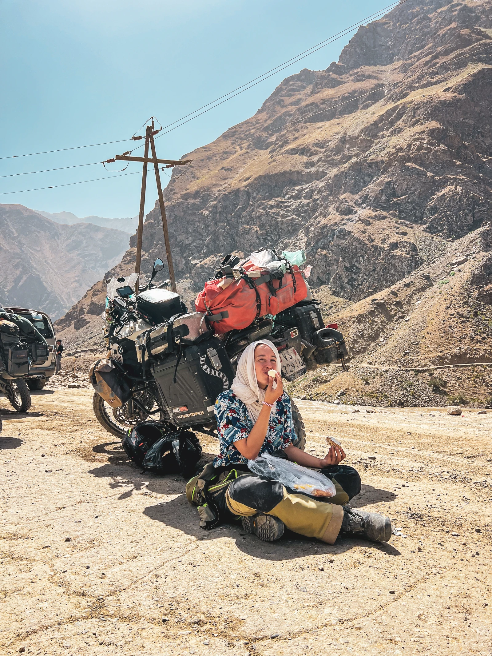
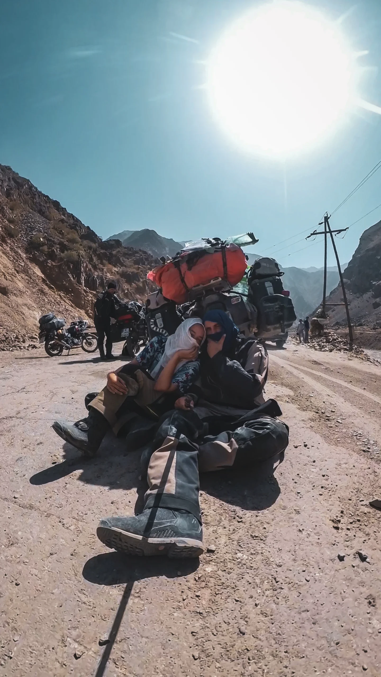
Construction stops on the lower Pamir can last 1–3 hours. You wait in the dust behind a line of trucks, in 40°C heat, breathing fine grit. We hid in the shadow of Falkor, shared water, and played cards on a rock. It’s part of the deal. It also gives you time to look at the mountains properly.
Roads That Decide Their Own Schedule
Flood damage near Khorog kept the Wakhan road closed for days. We almost took the alternative route, and missed what turned out to be the highlight of the trip. The lesson: on the Pamir, flexibility is not optional. The road has an agenda and you’re a guest in it.
River Crossings Without Knowing What’s Below
The morning guidance on the Wakhan says: cross before noon, when meltwater hasn’t filled the rivers yet. We respected this rule. Others didn’t. The Dutch couple we met at Bibi Fatima had survived their car being swept off the road by a flash flood that morning. Some crossings look manageable until they aren’t.
The Weight of Riding Two-Up
Every technical section, every steep descent, every sand trap on the Wakhan, we navigate it together on one motorcycle. The physical and mental load is different to riding solo. Natha stands on the pegs for hours to save the suspension. We discuss every line together. It’s teamwork in its most essential form.
Our Greatest Memories of the Pamir Highway
Three Years, and a Falkor Cake
Arriving in Dushanbe on our 3rd travel anniversary, crossing the Death Tunnel at dawn, and finding a Falkor-shaped chocolate cake waiting for us at Green House Hostel, made by Seb, Sander and Iris. Some moments surprise you so completely that tears are the only reasonable response.
Swimming at 4,000 Metres
Jumping into the glacial lake at Karakol, five riders, screaming from cold, laughing uncontrollably. The kind of moment that doesn’t require any interpretation. It simply is what it is: pure, freezing, joyful aliveness.
Camping Under Lenin Peak
Wild camping at the foot of a 7,134-metre giant, with marmottes as neighbours and horses grazing in the valley below. Vins riding freestyle through the steppe for the first time in 3 years. A sky dense with stars. One of those nights you don’t sleep much because you don’t want it to end.
The Swiss Watch at the Border
A stranger unclasping his watch at the Kyrgyz border and giving it to Natha because she mentioned missing home. That gesture, small, immediate, without hesitation, reduced us all to silence. Three years on the road and humans still manage to surprise you.
A Raptor at Ak Baital Pass
Reaching 4,655 metres, the highest point of the Pamir Highway, and being immediately circled by an enormous bird of prey. We stood there, out of breath from raising our arms to take photos, watching it. We decided it was a sign. We still believe it was.
Sharofat and Her Family in Khorog
The warmth of our Pamiri host, the stories of her land, her niece’s extraordinary piano playing in a room that doubled as a family museum, the hammock in the garden where we spent an entire afternoon doing absolutely nothing. Sometimes the road gives you exactly what you didn’t know you needed.
What the Pamir Highway Taught Us
Riding with others changes everything
We’d spent years riding as a couple, mostly solo. Sharing the Pamir with Sander, Iris and Seb showed us another dimension of long-distance travel. Shared problems are halved. Shared joys are multiplied. And strangers who ride the same road become people you’d trust with anything.
Prepare your motorcycle, then trust it
Falkor gave us a few tense hours in the heat. But his preparation, clean filters, a full service before Dushanbe, good tyres, meant he never left us stranded. Prep the machine. Brief the mechanic. Then ride without fear. Fear doesn’t fix breakdowns; preparation prevents them.
Water and timing are life
The Wakhan crossings before noon. The rivers that double in size by afternoon. The passes that ice over at night. The Pamir operates on its own schedule, and those who respect water and timing travel safely. Those who don’t occasionally end up in the river. We saw it happen to others.
Flexibility is not a compromise, it’s a skill
Our Wakhan detour almost didn’t happen because of a flood. The Death Tunnel happened because the mountain pass would have added too much time to a symbolic day. The Pamir rewards people who can read the situation and adapt, not those with the most rigid itinerary.
Disconnection is a gift, not a punishment
For days on the high plateau, there was no signal. No notifications. No social media. Just the road, the mountains, and the five of us. The content we made in those moments, driven purely by the desire to capture beauty, not to post it immediately, is the best we’ve ever produced.
Pamiri hospitality will restore your faith in everything
In a region that is genuinely impoverished, people gave us their best rooms, their warmest food, their most complete attention. The sandals retrieved and forwarded by a stranger. The borrowed yurt family. Sharofat running out to give us road news. Human kindness at altitude is a specific and powerful medicine.
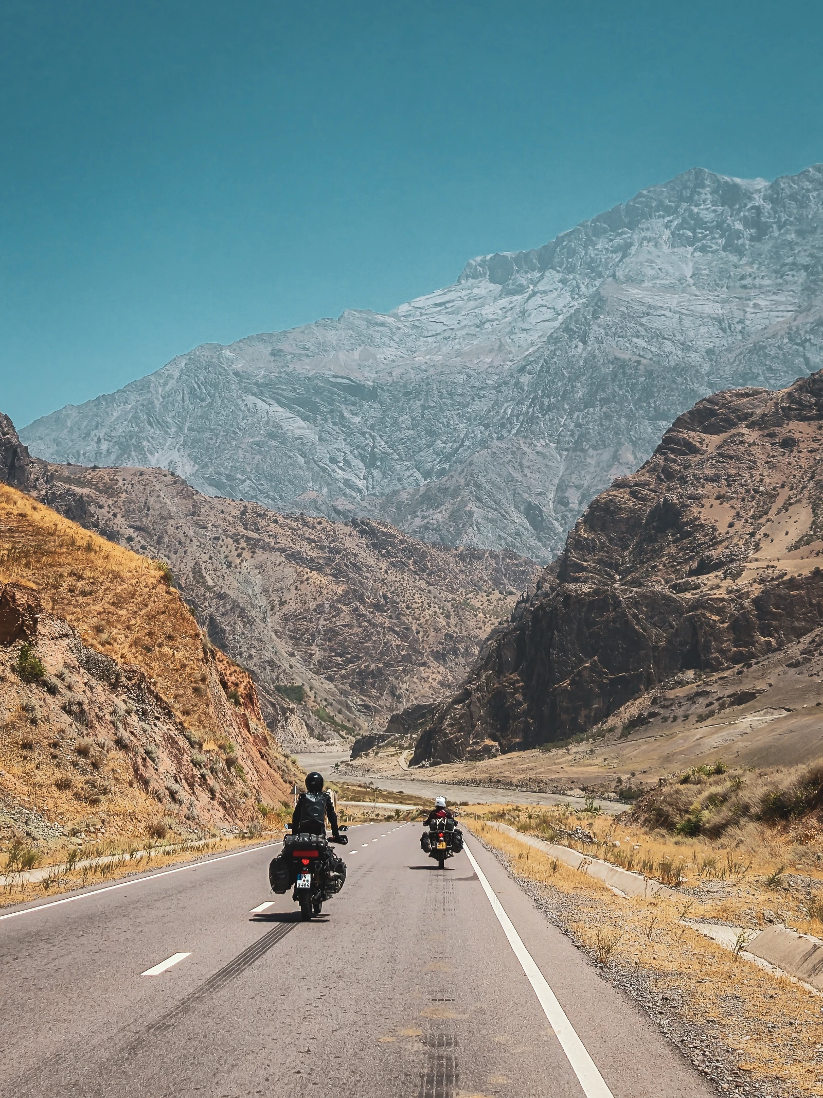
The Pamir Highway in Pictures
Click any image to view it full screen.
🏔️ Pamir Highway Quick Summary, Everything You Need
- Get your GBAO permit in Dushanbe (1 day, ~$20, bring 10+ photocopies)
- Last 95-octane fuel in Kulob, carry a 5–10L reserve after that
- Withdraw enough cash in Dushanbe, ATMs are rare on the highway
- Visit Aziz at Bike House in Dushanbe for mechanical prep and a full briefing
- Cross rivers and flooded sections before noon, meltwater rises in the afternoon
- The Wakhan Valley detour is longer and rougher than the M41 main road, and worth every extra kilometre
- The Kyzyl-Art border (TJ→KG) requires your name pre-registered in the customs book, arrange through a hostel or agency in advance
- Best time to ride: July–August. June is cooler but snowier on passes. September is beautiful but cold at altitude
- Download offline maps (Maps.me or OsmAnd) before leaving Dushanbe, signal disappears past Khorog
- Use Polarsteps to document every stage and follow our complete trip diary
Should You Ride the Pamir Highway? (Yes. Always Yes.)
When people ask us, « Is the Pamir Highway dangerous? » And the honest answer is: it’s demanding. It’s remote. It requires preparation, flexibility, and a motorcycle that has been properly serviced. Rivers can rise. Roads can close. Altitude affects you before you realise it. Fuel is not always where you expect it.
However, dangerous? Not in the way people imagine. What the Pamir Highway is, above all, is serious. It takes you seriously. It asks you to be present, attentive, and humble, and in exchange, it gives you some of the most extraordinary landscapes, people and experiences available to a human being on a motorcycle in the 21st century.
Specifically, we rode it two-up, on a 10-year-old BMW, with a handmade license plate we built in a Mad Max shipping-container town, with friends we’d met by accident at borders and campsites. We swam at 4,000 metres, kissed at 4,655 metres, cooked pasta in the dark at the Seven Lakes, and cried at the exit of a Soviet tunnel on our third travel anniversary.
The Pamir Highway doesn’t just take you somewhere. It reveals something. About the world, about the people in it, and about who you are when there’s no mobile signal, no comfort zone, and nothing but the road and the mountains and the people riding beside you.
Ride it. You won’t be the same when you come out the other side. That’s the whole point.
You can find our complete day-by-day travel diary of this entire journey, every stage, every camp, every breakdown and every beautiful moment, on Polarsteps. For the full context of how this chapter fits into our bigger journey, read our Year 3 article. And if you want to know more about who we are and why we’ve been doing this since 2021, start here.
The Road Doesn’t End at Osh.
Neither Does Our Story.
We’re still riding. From Kyrgyzstan to China, Laos, Thailand, and wherever the next bottle spin takes us. Follow along across all our platforms.